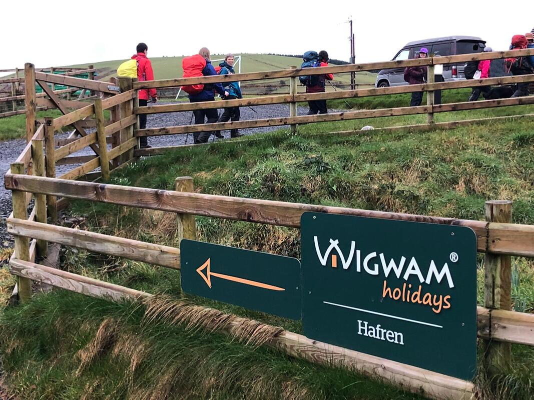
 Introduction Wigwam Holidays Hafren is situated in the most northern part of the Cambrian Mountains, near Staylittle in Powys, ideally situated for walks and right on the doorstep of lots of lead mining history. Nia and Endaf Meddins are the owners of the 6 pods and they keep the pods and the site spotlessly clean. They are cosy, warm and well equipped. I’ve lost count of how many walking recces I have done in the area, trying out different routes both on PROW and on open access land. It’s a beautiful area, remote and unknown to many; varied terrains, spectacular views and lots of history. There are some areas that I have discovered on my walks that I really love and so I keep going back; Hengwm Valley, the two lakes at Bugeilyn and of course Clywedog Valley and Castle Rock. I have still more recces to do, more to see, and more to learn about. I was introduced to Nia Meddins last summer by Dafydd Wyn Morgan, Project Manager for Mynyddoedd Cambrian Mountains. Last summer we did a recce for a possible event using Nia’s pods. I was struck at how remote, beautiful and unvisited the area was and have been getting to know it ever since, looking for suitable walks for Nia’s guests and for bigger walking events. After discussing with Alan Ward of Bigfoot Services (who has provided all my training), he and I thought it would be an ideal walking event for a walking group from the Brecon Beacons. 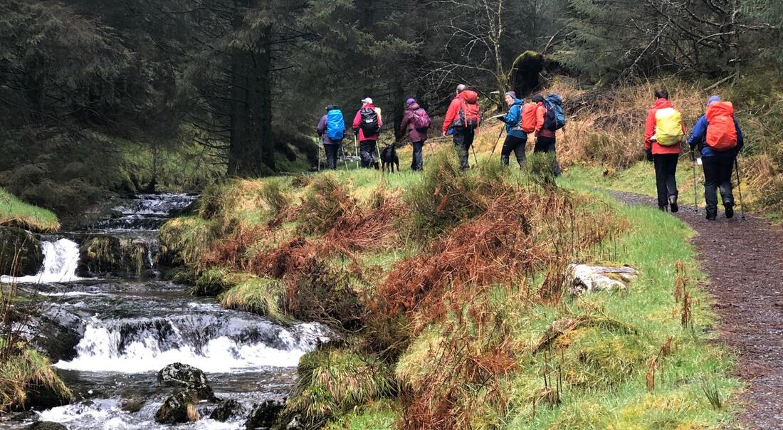 Before I continue, I have to mention Covid-19 aka corona virus. On the day that the event started, 18th March 2020, there was only guidance for avoiding contacting and advisories for people in high risk categories. The Star Inn was still open for drinks and meals – the only guidance was to avoid restaurants. Some of the participants for my event had traveled far to get to the pods and the pub was more than happy for us to eat there as it was very likely that we would be the only ones there given its remote location. Nia had been advised to shut down the hot tubs which suited us as it was too cold in any case. So, it did cause me some worry and deliberation and I feel it only went ahead by the skin of its teeth. By the evening of the last day, 20th March, the pub was shut after Government restrictions had been enforced which also included, leaving your home only when absolutely necessary, only going out once a day for exercise, walking 2 metres apart and only with family. 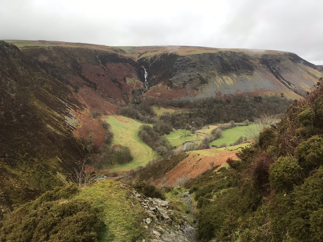 Day 1 Pennant Valley - 8km After everyone had arrived and settled in, I gave the group a quick briefing in the rain before setting out directly from the pods. Walking up the lane towards Nia’s farm and up onto the bridle way, looking out for a footpath heading more-or-less north towards the mountain road and the top of Pennant Valley. Crossing the road with care, as this stretch of road seems to be a bit of a racetrack, we then took the bridleway that climbed slightly to give us views of Ffrwd Fawr (great stream), where the Afon Twymyn falls 50 metres. Thankfully at this time of year we had a better view than usual - with recent heavy rain falls and no leaves on the trees to block the view. Looking over towards the steep sided valley called Craig y Maes (field of rocks) is spectacular. The area of Ffrwd Fawr and Craig y Maes is an SSSI but unfortunately not open access. The path down to the base of the valley starts off extremely steep and rocky, so I briefed the group before we began our descent. There was no rush and care was needed. Looking across the valley we could see the Nant Ddeiliog (leafy stream) waterfall, also spectacular. After crossing the Afon Twymyn (river fever) we weaved our way through, what seemed like a deserted commune. I found it quite spooky but others thought it was quite intriguing. The path from here is called Llwybr y Ceirw (the path of the deer) - it deserves having such a name because it is so steep. The path zigzags, covering a walking distance of approx 0.7km (from where you enter the wooded area to the stile at the top), you gain 200m in height. Again, there was no rush so we all took it very slowly. From the stile at the top there are fantastic views north, down the beautiful Pennant Valley. 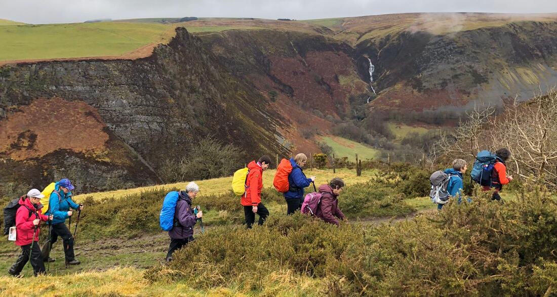 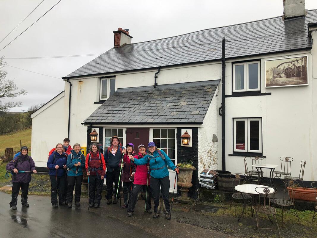 Onwards then to the shallow ford across Nant Bryn-moel (bare hill stream), a short stream that joins the Twymyn only metres before the 50m fall. One member of the group didn’t really have suitable footwear for crossing the stream, although it wasn’t very deep, possibly 200mm, so was given a piggy-back across. We were all ready for a drink at The Star Inn which was on route back. The proprietor had opened specially for us and had the fire lit – very welcoming. A great choice of drinks to suit everyone and we all put our food order in for dinner later. The return to the pods was only 2.5k from here, taking a bridle way opposite the pub and intersecting with Glyndŵr’s Way on Dylife Hill. This used to be the old mountain road before the existing road was built that goes from the Star Inn to join the Llanbrynmair road. We followed this track, going southeasterly until reaching Nia’s farmyard and then on to the lane back to our cosy pods. A great walk to warm us up for the big walk the next day – fantastic company, everyone being keen walkers who didn’t mind a bit of drizzle. After a bit of relaxation and time to change we went in my car, a Mazda Bongo, to The Star Inn. It was a great evening and the food was lovely, service great. The Star Inn was once one of 3 pubs in Dylife in the 1800s. 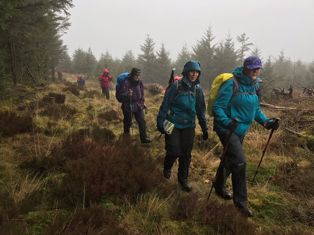 Day 2 Source of the Severn – 17km We left a car at The Star Inn the night before as today’s walk was a linear one. Setting off at a round 9am we drove in two cars to Cwmbiga. A bit of a damp start, we were expecting the drizzle to turn more snowy as we gained height. The route up into the Hafren Forest I chose because it is a less popular public footpath and the first section is amazing – like something out of The Lord of The Rings; the damp ground and the gap in the trees has allowed enough light in for all kinds of moss to flourish and with the mist as well it looked magical. Eventually at a height of 402m we converged with The Severn Way at Blaen Hafren Falls. This is always a very civilized spot for a break given that there is a picnic bench, views and is right next to the falls. So, from here it’s a very well-maintained path right up to the source of the River Severn. The path follows the young River Severn as it cascades down – very spectacular and pretty. On reaching the open access land there is a stark contrast in terrain, and it makes you wonder what kind of terrain they decimated to plant the forest in 1937. The path continuing upwards is paved and again well-maintained and meanders next to the ever-decreasing width of the River Severn up to the source at a height of 610m. The site is in the middle of boggy area of peat. We could see snow on higher ground and were still getting the odd flurry. Just beyond here, going northwesterly there is a boundary stone, spot height (618m) and cairn. From here there are fantastic views of which there are none at the source of the Severn. 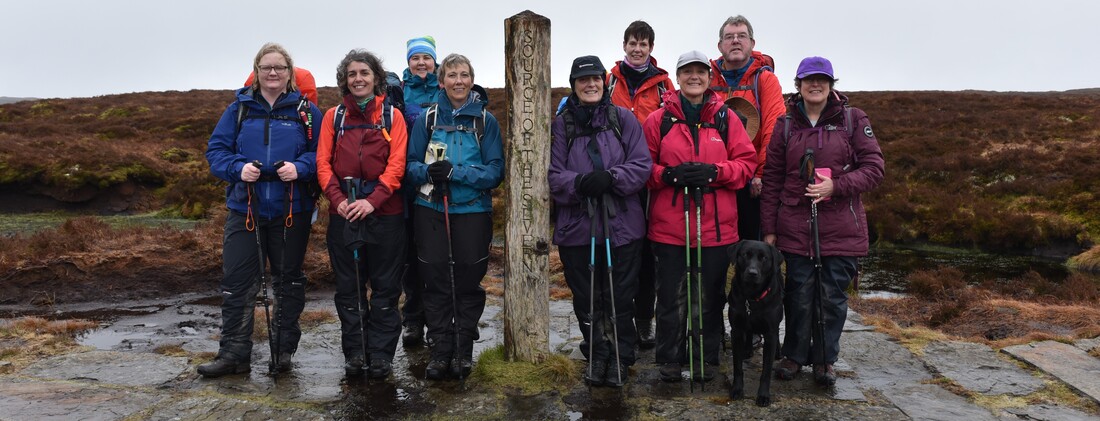 Following the boundary and stopping at Carnfachbugeilyn a Bronze age site, at a spot height of 622m (the lake of the shepherd's small cairn). It would be mostly downhill from here to our lunch stop, planned at the small water fall just below the next isolated boundary stone. Following the county boundary on a bearing would mean crossing very rough terrain so I chose to follow the boundary fence a bit further before cutting across northwesterly to the waterfall. It was still a matter of picking your way through and following a vague path. The waterfall, although small, I think is quite spectacular as there is a sudden rocky fall of about 3 metres at the top of the re-entrant and the water seems to appear out of the ground and splashes down noisily, over bright green moss to a small pool before flowing down into the Hengwm valley. We all enjoyed our lunch stop here. 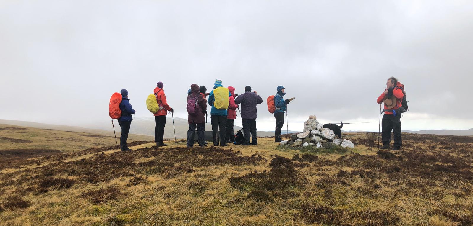 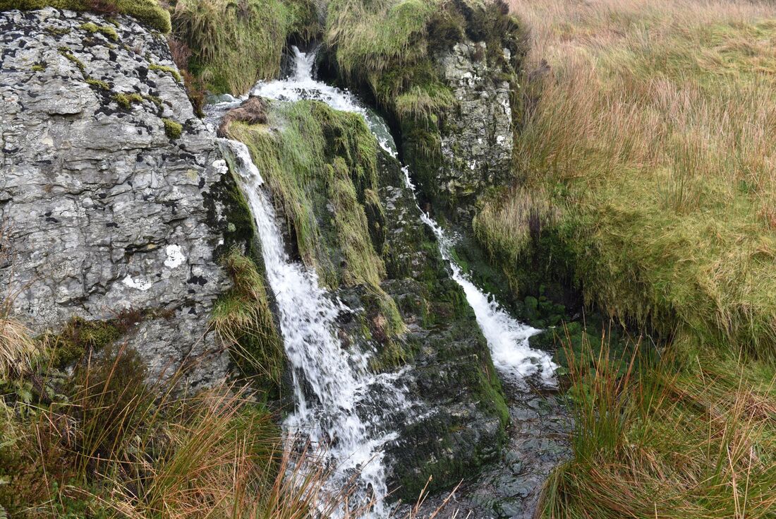 A path is quite clear from here, albeit only a sheep track, but this took us to the best route across the water shed area at the top of the valley. I had recced the crossing a number of times, looking for either animal tracks across or quad tracks which are easier to spot when looking down from higher ground so I had recced it in both directions. I asked the group to go in single file across and to follow my path exactly as I didn’t want any mishaps in the boggy ground. My chosen route is quite safe and not too boggy. When we get near the manmade, underground water channel on the other side of the valley base it gets a bit wet but is ok if you keep going. The peat bog here, at the water shed, I think is amazing; a huge area with great mounds of peat that are actual islands in a mass of water. The manmade outlet from Bugeilyn is marked on the map as a very straight blue line and is accessible to go and have a look at. The water then travels underground down the Hengwm valley, marked by wooden posts and large metal grates and the ground above is always mown. I’m not sure how far this water diversion goes, maybe just past the peat bog. When I’ve been here on my own the echoey sound of the water rushing underground is quite spooky. Looking down Hengwm from here it is spectacular; it’s so remote, quiet and like nowhere else. In the summer the base of the valley is covered in bright green long grass, very beautiful. 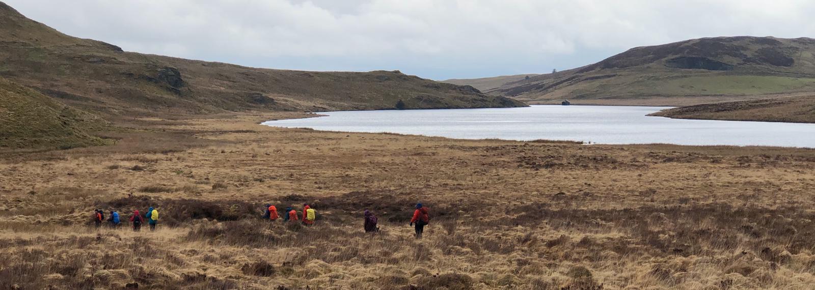 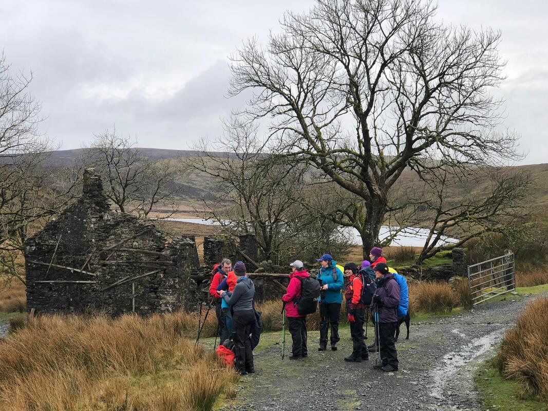 Up onto the track/bridleway from here, taking us over the bridge crossing the water channel that links Bugeilyn to Llyn Cwm-byr. Llyn Cwm-byr is damned at the other end. My conclusion of this management of water is that they (the water authorities) want a certain amount of the water from the two lakes to be flowing into Nant y Moch Reservoir instead of naturally flowing down into Rhaeadr Wen (white waterfall) and eventually to the Afon Dyfi. The channel of water looks particularly nice in the summer when there is a lovely spread of lily pads. Bugeilyn Farmhouse is more derelict every time I walk past which is such a pity. The east facing gable end is really bulging and looks about to fall. The modern farm building is on the site of Plas Bugeilyn - a big hunting lodge, built by a man called Sir Watkin in 1911 using material from the demolition of the dressing site in Dylife, including the mine manager’s house called the Plas. The demolitions dashed the villagers hopes of the mines ever getting reinstated. The big hunting lodge at Bugeilyn was demolished in 1984 after it had been abandoned for years, so wasn’t even there very long. 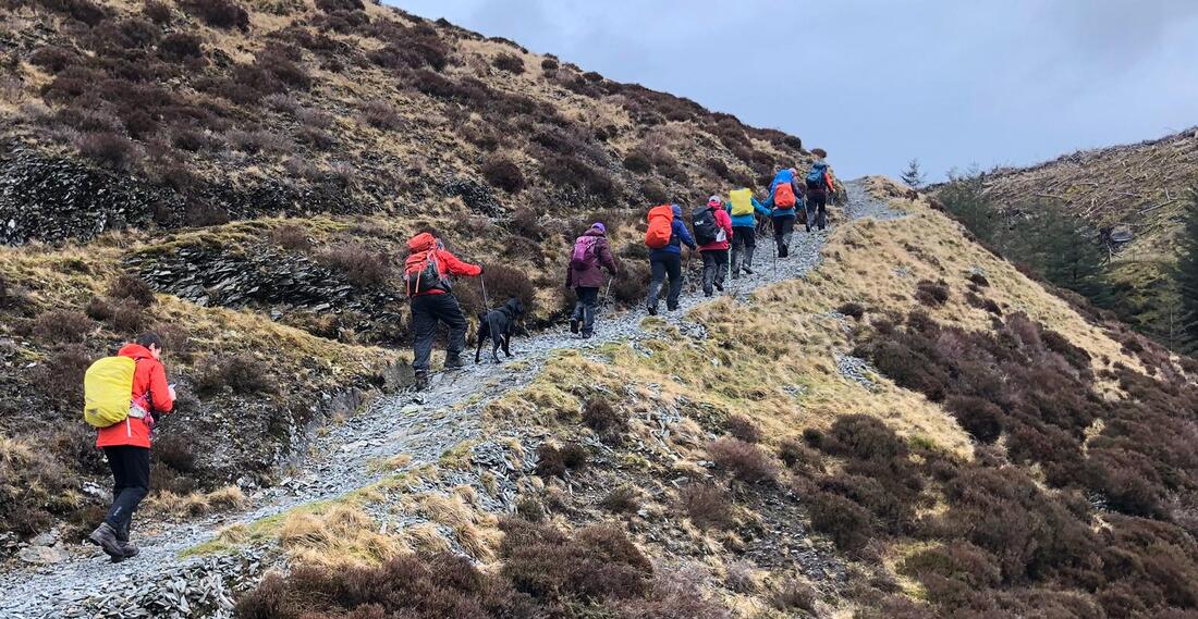 Along this part of the track from Hengwm to Glaslyn there are clear views of Cadair Idris, today we could nearly see the top - at least we could see some of it. As the track rises on the way to Glasyn we didn't forget to turn round to appreciate the view behind us too - we could see the summit of Pumlumon. Glaslyn didn’t look particularly blue but still fabulous with Foel Fadian clearly in view behind it. From Glaslyn we picked up Glyndŵr's Way, taking us firstly to the source of Nant Ddu where a reservoir was once made to feed firstly Cyfartha and then Dyfngwm Mine further down the Clywedog Valley. The damn is huge, still visual and marked on the OS map but the reservoir area has now returned back to a marshy area. A few metres downstream are the remains of where the water wheel was at Cyfartha; an amazing little ecosystem of water and ferns all year long between two stone walls about 1 metre apart. The Nant Ddu (black stream) flows on downstream from here for about 0.5km before it converges with Nant Goch (red stream), at the foot bridge, both streams then forming Afon Clywedog, meaning noisy river. 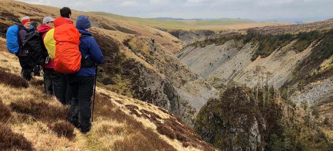 We took the lower footpath instead of continuing on Glyndŵr’s Way so we could get the best views of the mining valley and to be right opposite Castle Rock. Castle Rock is significant for a number of reasons but isn’t named on the map. It can be interpreted by the shape, contours and course of the river. There is evidence that mining took place here in Romans times and it was from the top of Castle Rock where Sion the Blacksmith was brought down and arrested for the murder of his wife and children in 1725. He had wanted to throw himself off into the deep pool below (Llyn Sion y Go) - to be honest he would have suffered less if he’d managed to jump off in time to escape his capture and trial. Castle Rock was also was said to be ‘The finest natural exposure of a lode in the country’ – Mr. O.T. Jones, Professor of Geology and Mineralogy, Victoria University Manchester 1922. A lode is mineralised ground in the form of nearly vertical veins containing ore (lead in this case), mixed with material of no value such as quartz and other rock. Just up the steep bank from here is a square boundary marked on the map. It is a very visible feature on the ground but with no name on the map or any reference in the Dylife Guidebook. Quite interesting though. From here, to meet back up with Glyndŵr’s Way we passed ‘open mine shaft territory’ so great care was taken. Some of the shafts are open and not fenced, some are filled but sunken. Joining up with the old mountain road, we then took a right on to a bridle way to bring us to where the huge Red Wheel was situated, sometimes called Martha Wheel or Rhod Goch. It was 63ft diameter and the largest of its kind in Wales. The footings of the building here still remain and so does a rusty old kibble. In this abandoned area between here and The Star Inn was the dressing area for the mines, the old post office, a chapel and the Manager’s House called The Plas, which is the property that was used to build Plas Bugielyn. The footings of The Plas are marked on the map so must be visible on the ground. To our right along this small valley, shafts can be seen and also Llechwedd Ddu Engine Shaft. 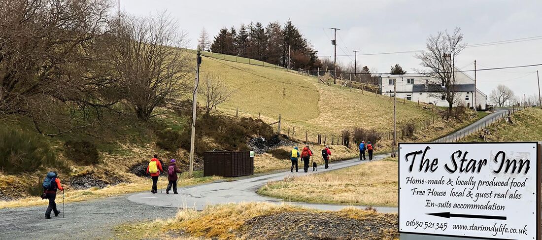 Crossing the road the graveyard and the footings come into sight of St.David’s Church. The church was demolished in 1962 and there had also been a school next to it. All the gravestones remain and it is worth a look, on another occasion, but we were on the home straight to The Star Inn - we received a very warm and friendly welcome on our arrival! We put our orders in for our dinner and we returned later to enjoy another lovely meal, drinks and a great evening. I would like to thank everyone who took part on this event (hardy walkers!), Nia and Endaf Meddins for their fantastic pod accommodation and Alan Ward for his support and technical advice with route planning and risk management. Historic references are taken from Dylife written by Michael Brown. All translations from Welsh to English are literal.  
0 Comments
Leave a Reply. |
Archives
April 2024
Categories |
 RSS Feed
