  I have a lot of favourite places in Wales; places that you can only get to on foot, places that aren’t that popular, off the beaten track. They probably don’t have the big wow factor for the average person but for me, I like something that ‘the crowds’ aren’t all gawping at - something that feels special and something that feels like treasure. I don’t keep these places secret, in fact usually when I come across what I think is treasure, on a recce for instance, I can’t wait to bring people to the same place to share my experience. One of those places is the Pumlumon massif. Pumlumon Fawr has 5 peaks (Pumlumon means 5 peaks). The highest peak (2468ft/752m) is the highest in the Cambrian Mountains. Pumlumon isn’t as popular as Snowdon or Pen y Fan but that to me is its attraction. It is seriously under rated; you don’t have to queue for a drink when you get there (you take your own), you don’t have to wait your turn to do a selfie at the trig point and you don’t stand a chance of literally bumping into anyone. Because of this, this mass of rock will have looked the same for centuries, for thousands of years, since it grew into a mountain – for this reason I’m interested to see what old guides books have to say about Pumlumon, when people started to have time to venture out and appreciate our beautiful mountains. Below are a few extracts that I’ve found, and then I'll go on to tell you about my five experiences, when walking the five peaks of Pumlumon Fawr. Exploring Wales – William Condry 1970 ‘Cardiganshire has one true mountain-Pumlumon (pronounce it ‘Pimlimmon’) which, if you like, is a stray bit of Snowdonia for it is an outcrop of typically North Wales Ordovician rock poking through a blanket of Silurian rocks that cover much of central Wales…. And if you want to see both North and South Wales from one peak, then Pumlumon is your mountain.’ The Wye Valley – Ward Lock’s early 1900s ‘ This mighty mass, which rises to the height of 2,469 feet above sea level, impresses by extent rather than by altitude. It is one of the most watery and boggy mountains in Wales, and, from the want of well-defined paths, one of the most difficult to ascend….. Plynlimmon, indeed, may be described as a “watery mountain,” from the many streams which proceed from its sides.’ Wales It’s history and romance - WT Palmer 1932 ‘The track from Eisteddfa Gurig farm is easier to follow since the advent of a caterpillar tractor which in the holiday months, takes visitors to the summit in easy modern style. The trip takes about one hour and the tractor has made six journeys in one day.’ Evidently a much loved, documented mountain and thankfully the only caterpillars we might see up there today are the tiger moth and emperor moth caterpillars. 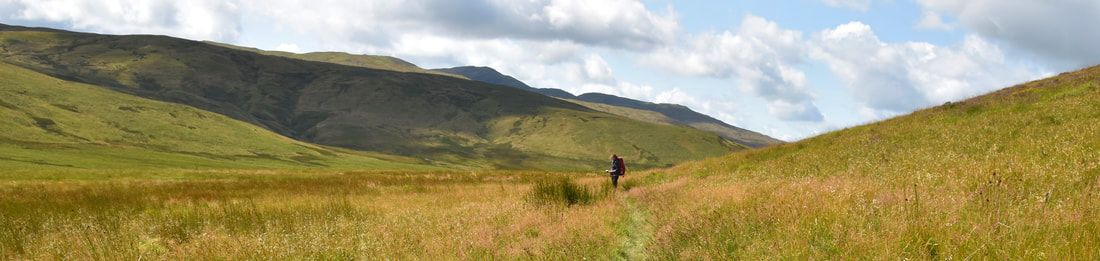 My Five Experiences My five experience should go some way to emphasise why this magnificent mountain is one of my most treasured places in Wales. My route takes me from Maesnant in the county of Ceredigion, up to the summit, across the Pumlumon Fawr ridge and down to Glaslyn in the county of Powys. Then a night in a glamping pod at Wigwam Holidays Hafren before a return journey back to Nant y Moch following the Afon Hengwm. 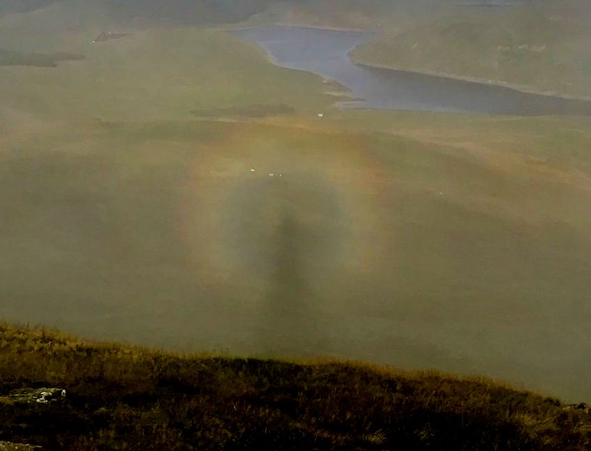 1. An Optical effect I’ll never forget An early start, in mid August, from Maesnant – I wanted to reach the summit before the sunrise and have my breakfast there too. It had been a very stormy last few days but today looked promising and so was the forecast. The start was fairly cool with quite a breeze pushing the clouds along quickly as I made my way up the mountain, following a small stream. I reached the summit at about 0530 and set up my stove ready for breakfast. The sunrise was spectacular as the clouds were moving fast. The orangey glow through the swirling clouds was very colourful – I stood and watched the ever-changing scene. Then at about 0745 something amazing happened. I was looking out towards Nant y Moch which was making appearances through the mist. The sun was behind me and still very low. I was actually making a shadow on the clouds right in front of me and then I noticed my shadow was encircled by a rainbow – A BROCKEN SPECTRE. Absolutely amazing, I was in the right place at the right time and something I’ll never forget.
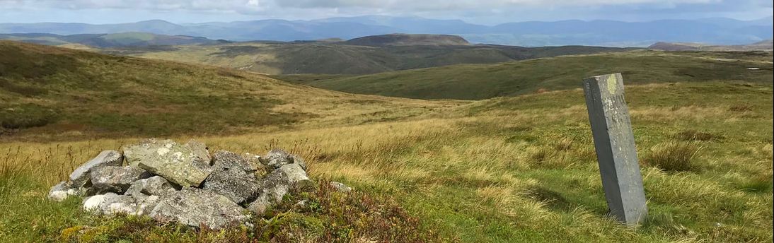
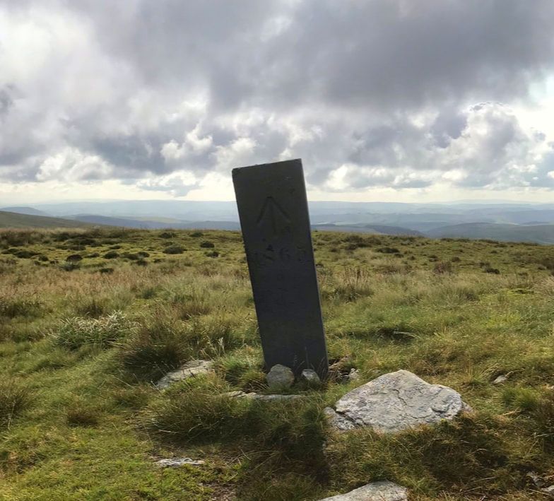
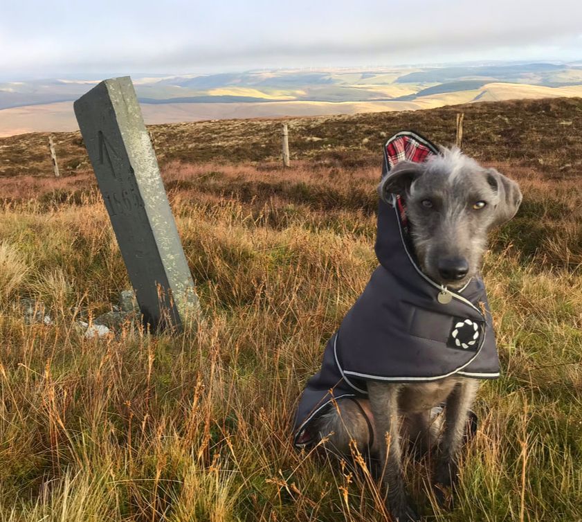
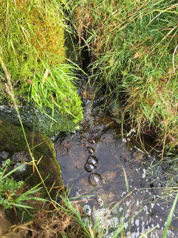 2. Three Sisters and George Borrow The story goes that Father Pumlumon had three daughters. He promised them as much land (for a leaving home gift) as they could cover in one day. Hafren, an early bird, covered a huge distance before reaching the sea. Wye, had a reasonable lie in and covered a shorter distance before reaching the sea and Rheidol completely overslept and had to rush straight to the nearest coast. So, the Severn (aka Hafren or Sabrina) is the longest river in Britain, all 127 miles of meandering water. I would be able to explore both the Source of the Wye and the Source of the Severn on this route that would take me across Pumlumon Arwysli and is quite straight forward, following the County Boundary. George Borrow was an English travel writer and based his books on his own experiences. He wrote Wild Wales in 1862, I’ve included a few extracts below- some great dialogue about the river sources. The Wye is a little harder to find than the Severn because it doesn’t have a massive vertical oak post marking the spot as does the source of the Severn, but with a bit of map interpretation the Wye can be found gurgling out of the ground at the top of a re-entrant that looks down towards the Hafren Forest. George Borrow - "And now, I suppose, sir, that our work is done, and we may go back to where we came from," said my guide, as I stood on the grassy hill after drinking copiously of the fountain of the Wye.” I stopped for a quick snack by the Cairns on Pen Pumlumon Arwystli (741m) before descending down to the Source of the Severn at 620m. The Source of the Severn is more remote and flows from a large area of a peaty bog. The great weathered mounds of peat are truly stunning and in my opinion beautiful. It’s great that the route from Hafren Forest is well maintained making this significant place very accessible. 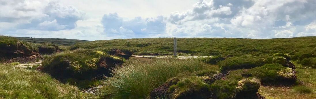 George Borrow - “ I have considered the matter deeply, and have come to the conclusion that here, and here only, is the true source. Therefore stoop down and drink, in full confidence that you are taking possession of the Holy Severn.…...Then taking off my hat, I lifted up my voice and sang:- "From high Plynlimmon's shaggy side Three streams in three directions glide; To thousands at their mouths who tarry Honey, gold and mead they carry. Flow also from Plynlimmon high Three streams of generosity; The first, a noble stream indeed, Like rills of Mona runs with mead; The second bears from vineyards thick Wine to the feeble and the sick; The third, till time shall be no more, Mingled with gold shall silver pour." 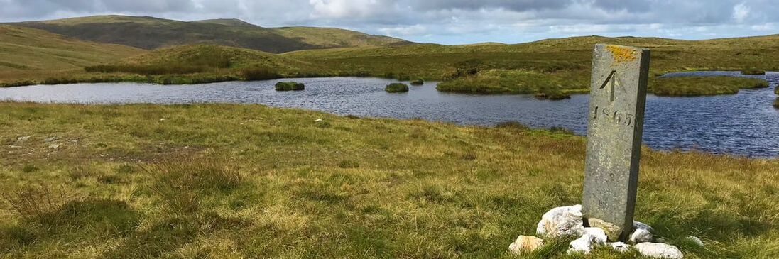 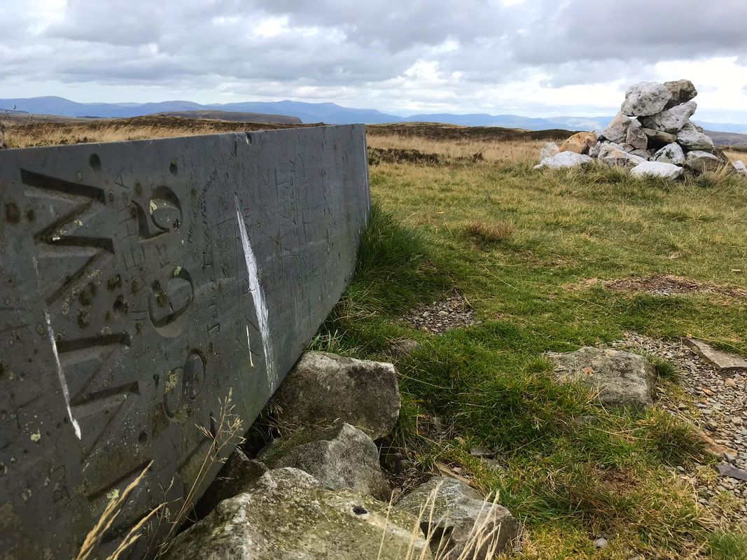 3. The Steadfast Boundary Stones Between walking from the summit and dropping down towards Bugeilyn I passed six boundary stones. They are made from slate and were put in place in 1865. They defined the boundary between Crown lands and the Watkin Williams Wynn estate. "WWW" is inscribed on the east facing side and an upward pointing arrow and 1865 on the west facing side. I think all the stones are registered with Coflein. I have two favourites on the way; the first one is nearest to the source of the Severn and is actually lying horizontal next to a white stone cairn. On a clear day the views from here are amazing- you can see the sea. My next favourite is near to a Bronze Age cairn which has unfortunately been hollowed, but still round and recognisable as a cairn. This Cairn has a name, Carnfachbugeilyn and is one of my favourite spots, I love the view down to the hills on the other side of Hengwn valley. It is said to be one of the great view of Wales and the best view of the two lakes Bugeilyn, Llyn Cwm-byr, on a good day you can absorb fantastic views of Cadair Idris and Aran Fawddwy too. The boundary stone that I would say was like finding treasure is where the County Boundary goes NW towards a small re-entrant. There is the most beautiful little waterfall (not marked on the map) and just above here, standing only about 300mm above the ground is a boundary stone. The ground is very boggy here so I can only assume that it has sunk over the years and now hides in the long grass.
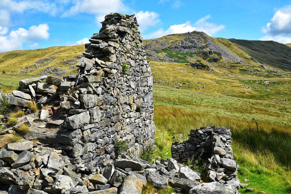
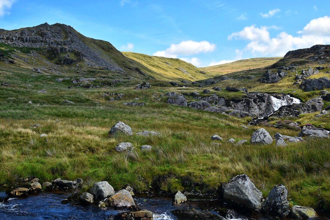
 4. The Hidden Lakes Coming down of the Pumlumon Fawr Ridge and then crossing the top of the Hengwm valley, I walked towards Glaslyn on a track. The two magnificent lakes Bugeilyn and Llyn Cwm-byr become very prominent. Approached from the other direction the lakes don’t come into view until you are nearly at the site of Plas Bugeilyn. When I think of all the times I’ve walked up here to the lakes, I’ve only seen a handful of people; one lady who was an artist and liked the scenery and tranquility, a fisherman, and a man and his son from Manchester researching their family history who once lived in Dylife. 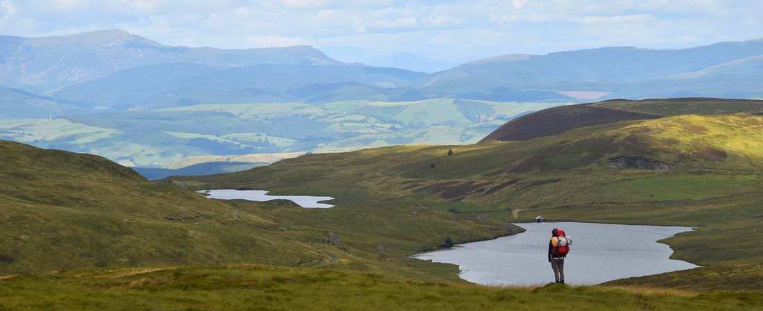 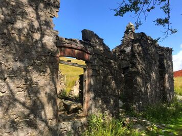 I’ve written a lot about Bugeilyn farm and Plas Bugeilyn in my last blog but I must mention that a couple of weeks ago when walking my dog in Dolerw Park, Newtown, I was chatting to a gentleman, because our dogs were playing together, and I happened to mention that I did a lot of walking around Staylittle. He then explained that his Grandma was born in Bugeilyn Farmhouse. Amazing! Every time I’ve walked passed that poor old ruin I’ve enjoyed imagining the hustle and bustle that would have existed there on the farm; the noise of the animals, cups of tea and chatter for passing fishermen or grouse shooters, the delicious smells of the meals cooked under that massive oak beam that is still visible in the remains of the fireplace and perhaps the cries of a new baby! 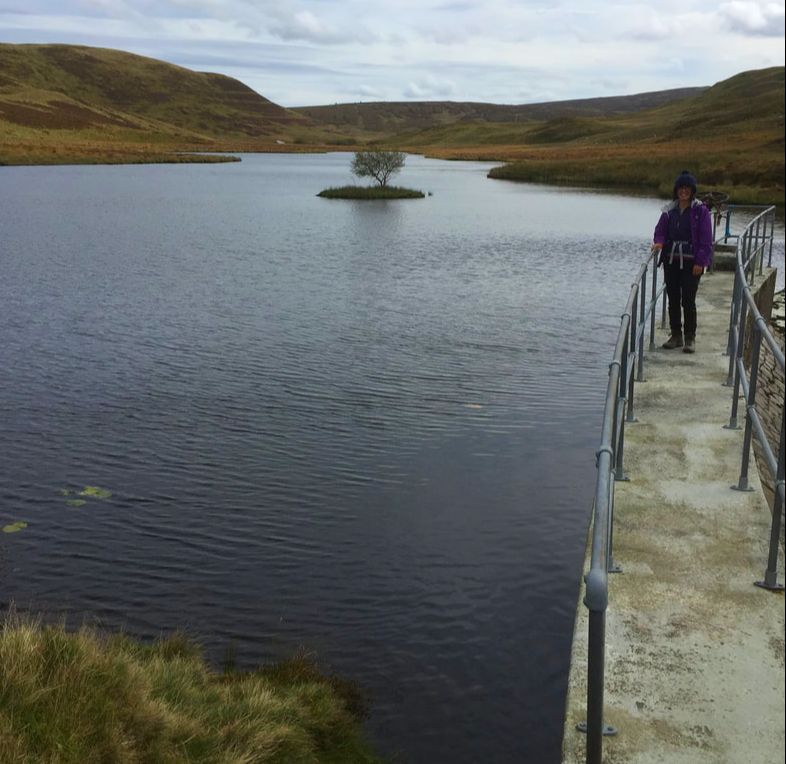 The best time to visit these lakes is in August when the skies are blue. The lakes are like blue mill ponds and decorated with waterlilies. Very pretty, very quiet and completely out of this world. Standing on the bridge crossing the water channel that joins the two lakes is a great place to quietly watch the wildlife. Generally, the birds are disturbed on my approach but if I wait long enough and stay still it all comes back to life. Llyn Cwm-byr has a small damn at the far end and worth a visit – accessible along the track from the tumble down farmhouse.  5. Hengwm - remote and deserted, but it hasn’t always been After spending a very comfortable night at Wigwam Holidays Hafren, Staylittle (highly recommended) and having a delicious full Welsh breakfast at The Star Inn, Dylife, I walked from Foel Fadian all the way down the Hengwm Valley back to Nant y Moch. Through past centuries this valley has seen a lot of different kinds of activity, all left now to our imagination. Today it is pretty much deserted but beautifully remote and spectacular. I was lucky to have fantastic weather and had clear views of Pumlumon Fawr to my left all the way. The river starts at the huge peat bog near Bugeilyn. Apparently after heavy rain, small but perfect flint tools have been found in this area, this would imply that it might have been a favourite hunting area in times gone by. 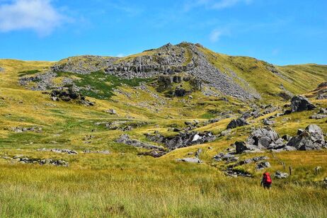 Looking in the direction of Pumlumon Fawr from here the valley looks remote and spectacular, thick long grass covers the base and somewhere in there, the river widens and gathers speed in a tight meander down towards Nant y Moch. The county boundary follows the meander exactly. Following the bridleway south west, the Afon Hengwm on my left, several small streams needed to be crossed, then at a small ruin the bridleway crosses the stream at the foot of Craig yr Eglwys (rocky church) named I think because of the spire-like rocks forming the hillside. Opposite Craig yr Eglwys (the other side of Cwm Gwerin, the Afon Gwerin being a tributary to Afon Hengwm) the rocks are called Graig y Lluest (rocky rapture). It makes me wonder when were they named and by whom? Perhaps early Christians spent enough time here to give names to places of significance or maybe named by the residents of the now ruins which are no longer even named on the map. The two properties are named as Lluest Newydd and Hengwm-annedd according to the OS map for this area 1898, so too are the rocky hillsides named. It’s a wonderful place and the waterfall here is beautiful – I wanted to get closer to it and if the river had been negotiable where the bridleway crossed (old OS map shows a footbridge) I could have got nearer but the river crossing was not even a consideration, and this was in the summer.
So, I stuck to the same side of the river - open access land in any case and there seemed to be a track to follow. Up on my right at this point is Carn Hyddgen where (or in Hyddgen Valley) a mighty battle was fought and won by Owain Glyndŵr in the summer of 1401 killing 200 English men, so I’m sure it wouldn’t have seemed remote, beautiful and peaceful on the day of that gruesome battle. The river is easily crossed by a footbridge at the end of the valley and then a track can be followed back to Nant y Moch. 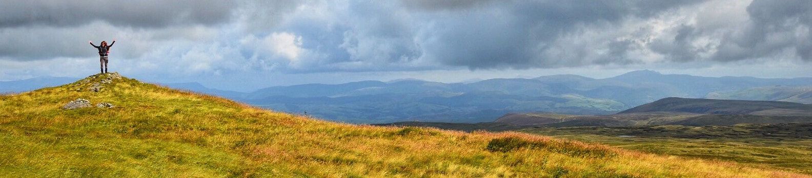 It is nice to think that history can never be changed; whatever happened on Pumlumon, whoever spent time there since its beginning. Only small clues have been left for us in some form, either by written documents or perhaps a lost flint tool - it all adds to the magical surroundings and experience. We can control the future, however, so let’s hope our great mass of rock, Pumlumon Fawr, will remain the same for centuries to come so that all generations who follow us can enjoy it just as we do. Lastly here is a wonderful poem by T Hughes-Jones 1895-1966. He went to school in Tregaron and won the Literature Medal for his story, "Sgweier Hafila" at the 'National Eisteddfod' in 1940. There aren’t many mountains that are worthy of a poem but Pumlumon Fawr has witnessed more than we can ever imagine leaving us with a wealth of history and intrigue - if only the rocks could talk. Tair Afon Fe gysgai tair morwynig Ar ben Pumlumon fawr, Sef Hafren, Gwy a Rheidol Yn disgwyl toriad gwawr. Meddylient godi’n fore A theithio’n rhydd a llon, A chyrraedd cyn yr hwyrnos Eu cartre ‘nghôl y don. Dihunodd Gwy a Hafren O’u cwsg yn fore iawn, A daethant ‘rôl hir diethio I’r môryn hwyr brynhawn. Ond cysgodd Rheidol ieuanc Heb bryder yn ei bron, Ac wedi hwyr ddihuno Rhuthrodd yn syth i’r don. A dyna pam mae Hafren A Gwy’n ymdroelli’n faith, A Rheidol fach yn rhedeg Yn syth i ben ei thaith.
Thank you to Dyfadd Wyn Morgan for the use of some of his photographs in this blog and for his company walking Pumlumon Fawr/ Hengwm.
References used for this blog Wild Wales George Borrow Exploring Wales William Condry Kitbag Travel book – Wales The Wye Valley – Ward Lock’s Coflein and RCAHMW
0 Comments
Leave a Reply. |
Archives
April 2024
Categories |

 RSS Feed
