The Land of the Eagles |
| Contents of this blog:
|  |
The Blog
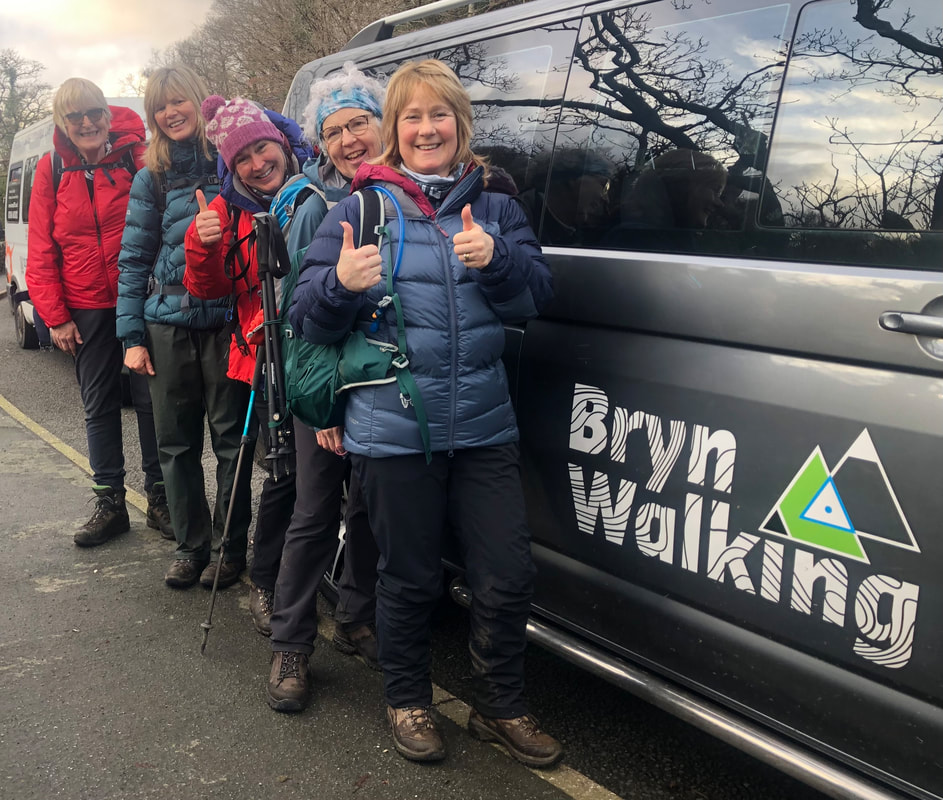
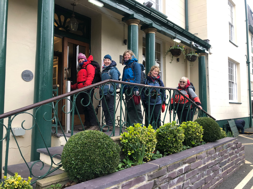
I arrived at Dol Peris guest house on Monday afternoon with Heather Maling, my assistant on this event. We awaited the arrival of the group who would be joining us for an exciting 3-day itinerary that would show them 3 very different and beautiful mountains, just a taster of Snowdonia. Some of it might be challenging but mostly governed by the immediate weather forecasts that promised high winds, so we had lowland contingency routes if summits weren’t going to be possible.
| Heather and I had stayed Sunday night in Eigiau Cottage, a bothy in an isolated valley on the northeast side of the Carneddau. The bothy is a small stone hut, homely and cosy but the valley itself has a foreboding and eerie feel about it; a long-abandoned slate mine with the dark slopes of Craig yr Ysfa behind, and of course the 990m long, redundant concrete dam that stretches across the widest part of the valley. 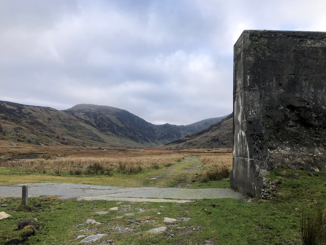 | 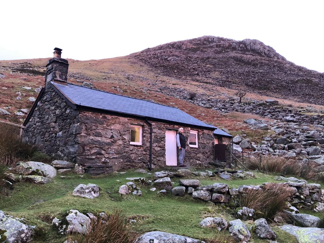 The ugly breaks in this ominous structure are a shocking reminder of the evening 2nd November 1925 when the foundations proved to be too weak and the dam burst, killing 16 people in Dolgarrog, the village below the slopes. Boulders weighing 200 tons were carried down the slopes and cows were left hanging from trees. It was designed to hold 4 million cubic metres of water (1 cubic metre weighs 1 ton). |
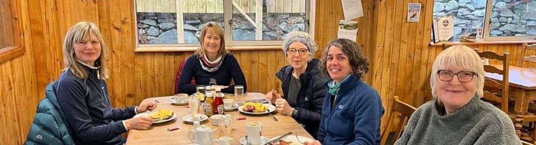
On arrival at Dol Peris a lovely hot shower was welcomed before everyone else arrived. The fire was ready to be lit and we soon felt refreshed and ready for the week ahead. Dol Peris Guest House is a beautiful Victorian house, spotlessly clean and all the facilities you need for a self-catering base. We sat round the stove in the evening, catching up, discussing the week ahead and checking the weather forecasts.
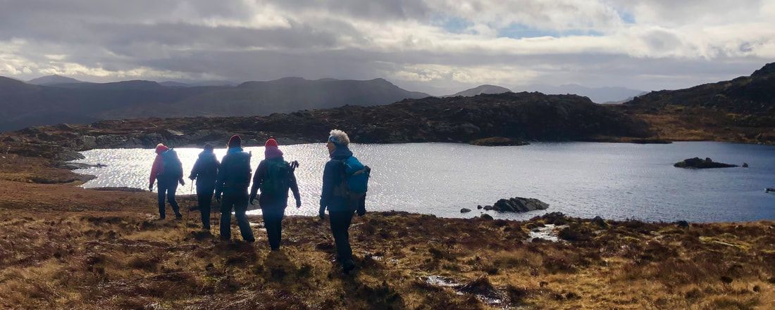
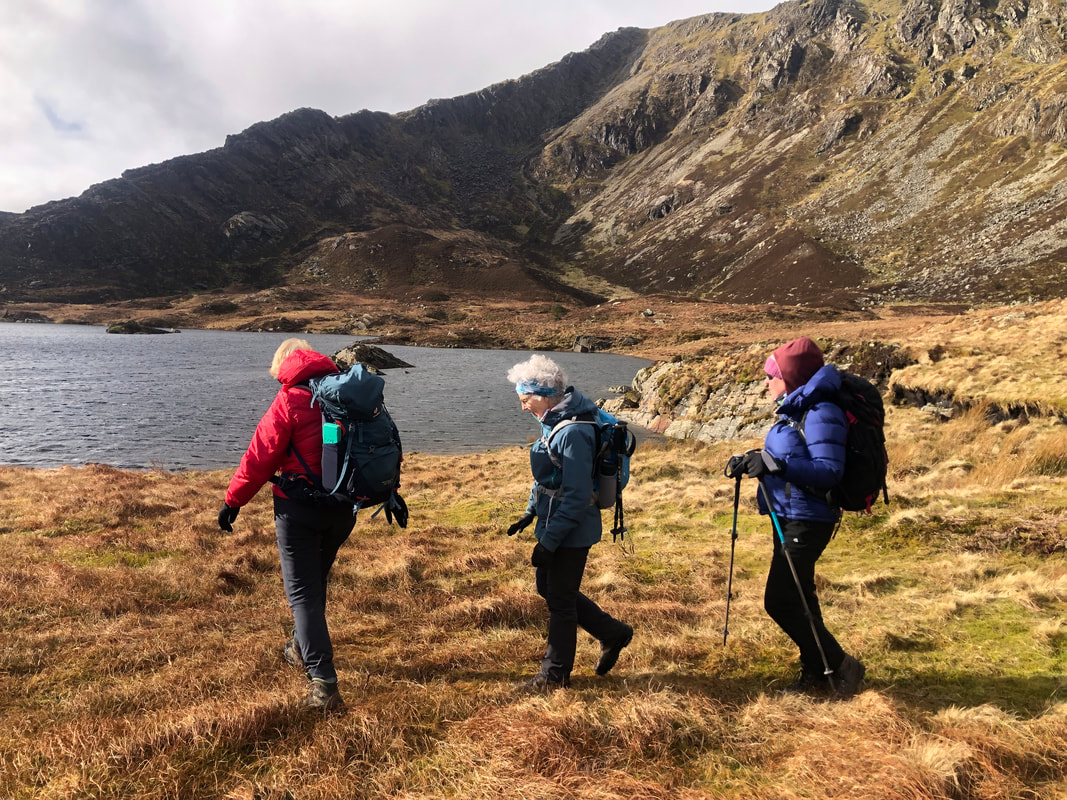
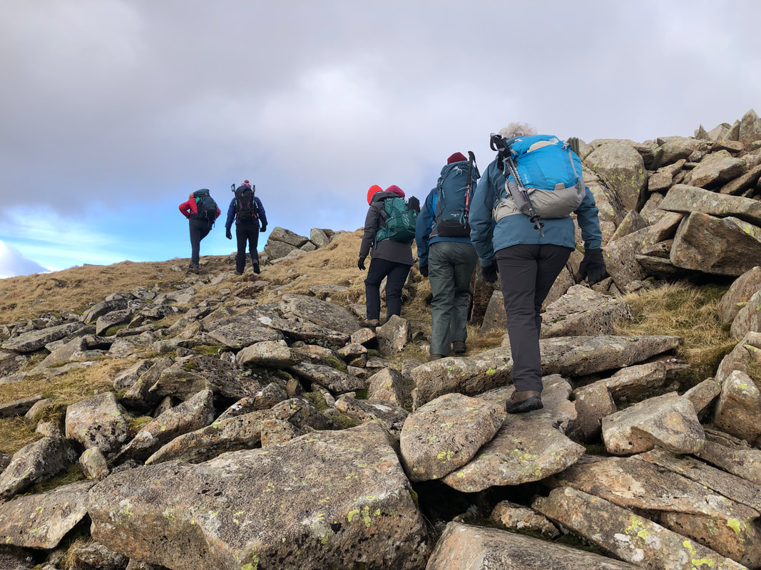
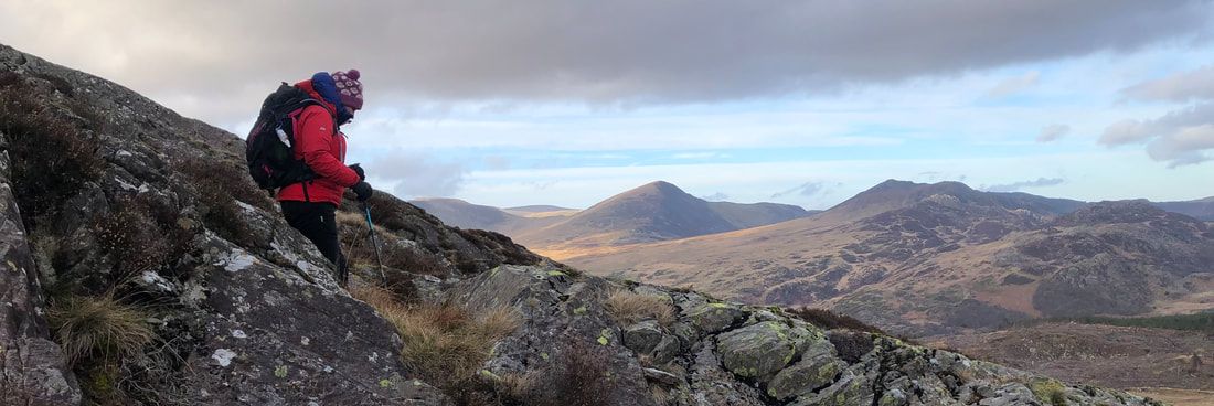
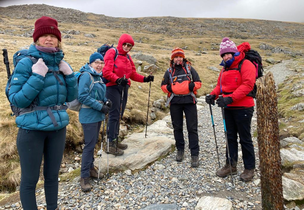
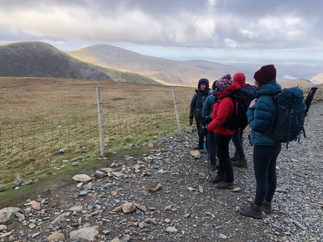
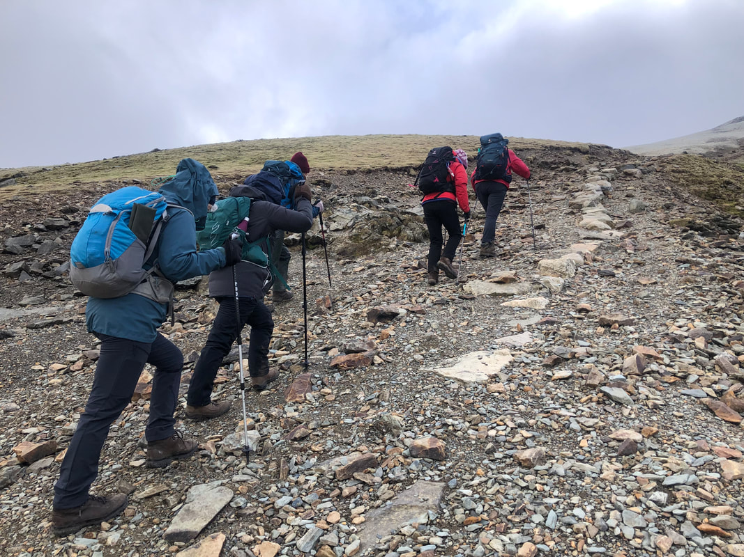
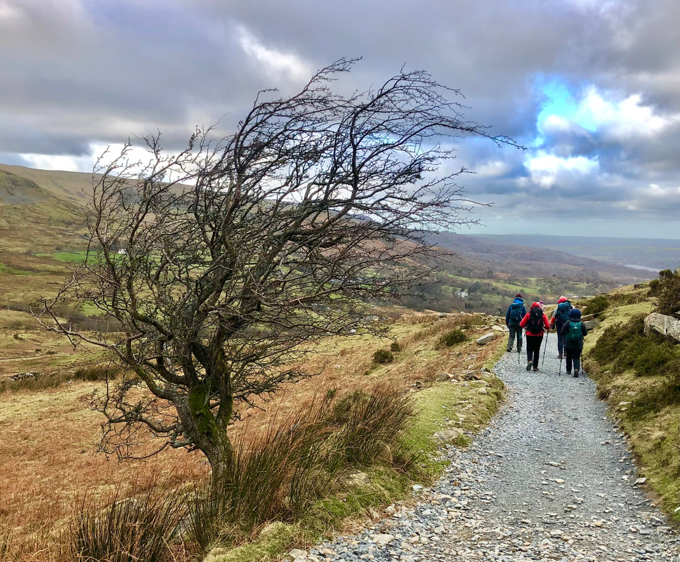
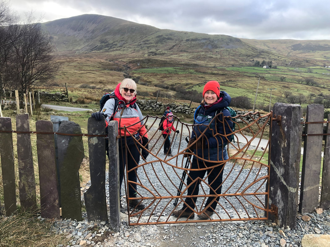
Day 1 – Moel Eilio (726m)
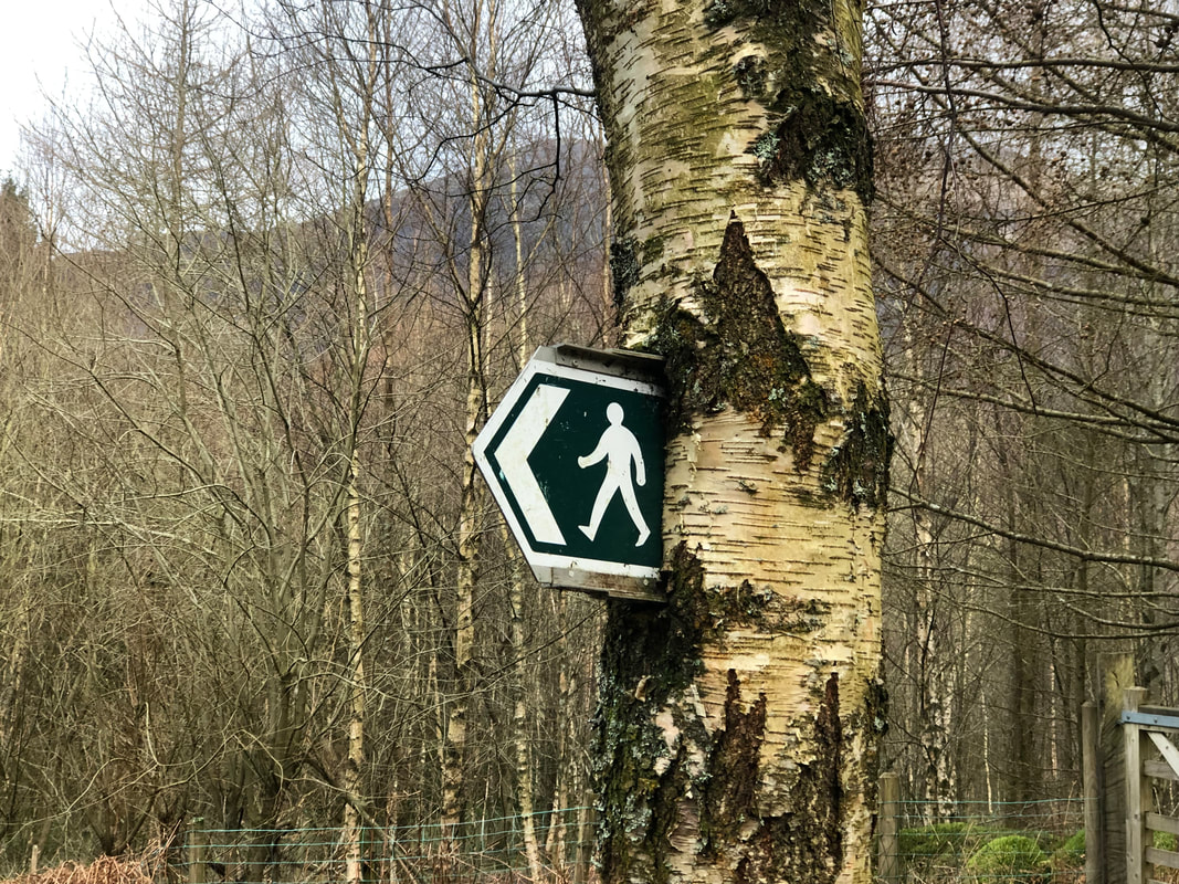
Heading out straight from Dol Peris at 9.15am was a great simple start to the schedule. A few very minor lanes to follow before reaching the open hill. I briefed the group of the walk and we all made sure that we had everything we needed for the day ahead. The kitchen had been a hive of happy activity getting a substantial breakfast put away and lunch prepared. Discussions and comparisons of clothing and layering was to be standard conversion for each morning.
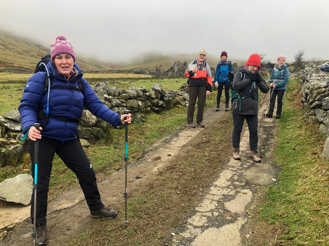 | One of the party, Sian, had stayed in a cottage on the slopes of Moel Eilio years ago and had brought with her a copy of the ‘typed’ notes and directions which included a grid reference. On the way up we were able to identify where she had stayed – it wasn’t one of the ruins… Once onto the open hill, and gaining height, we easily followed an old boundary, now just a long lump in the ground but quite distinct. |
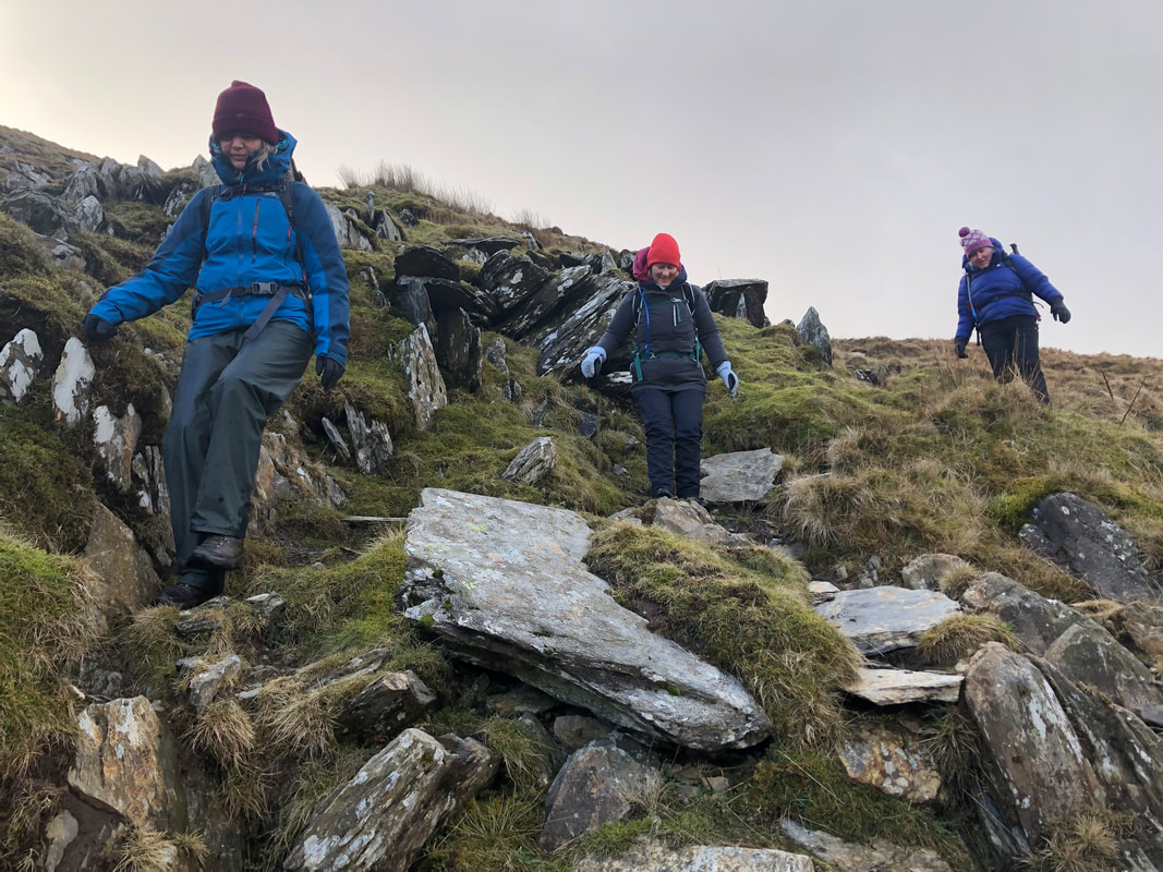
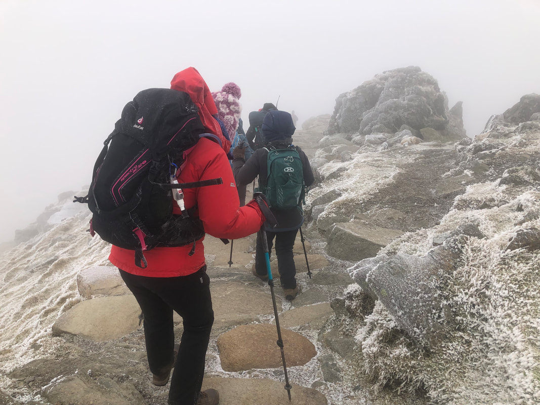
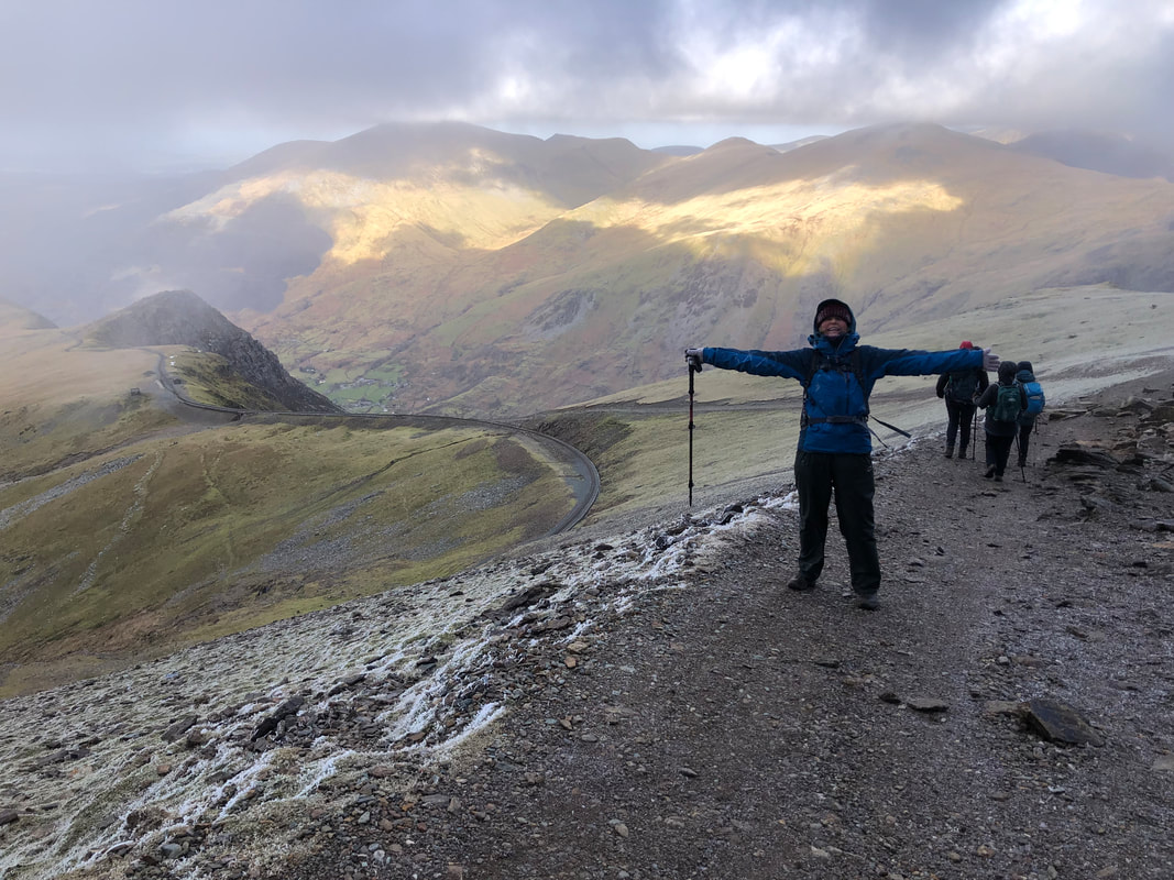
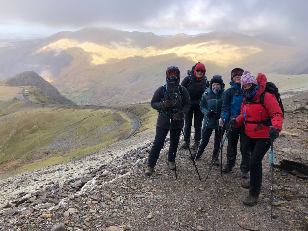
The gradient is gradual but soon increases at about 560m altitude to the summit at 729m. We were in thick cloud from about 450m and high winds. I was aware that the first part of the escarpment was fenced but not all of it and there was a part where I guessed the wind might prove to be too much. The direction of the strong winds being SW was not in our favour. I decided from the top that we would carry on but being prepared to turn back for the safety of everyone.
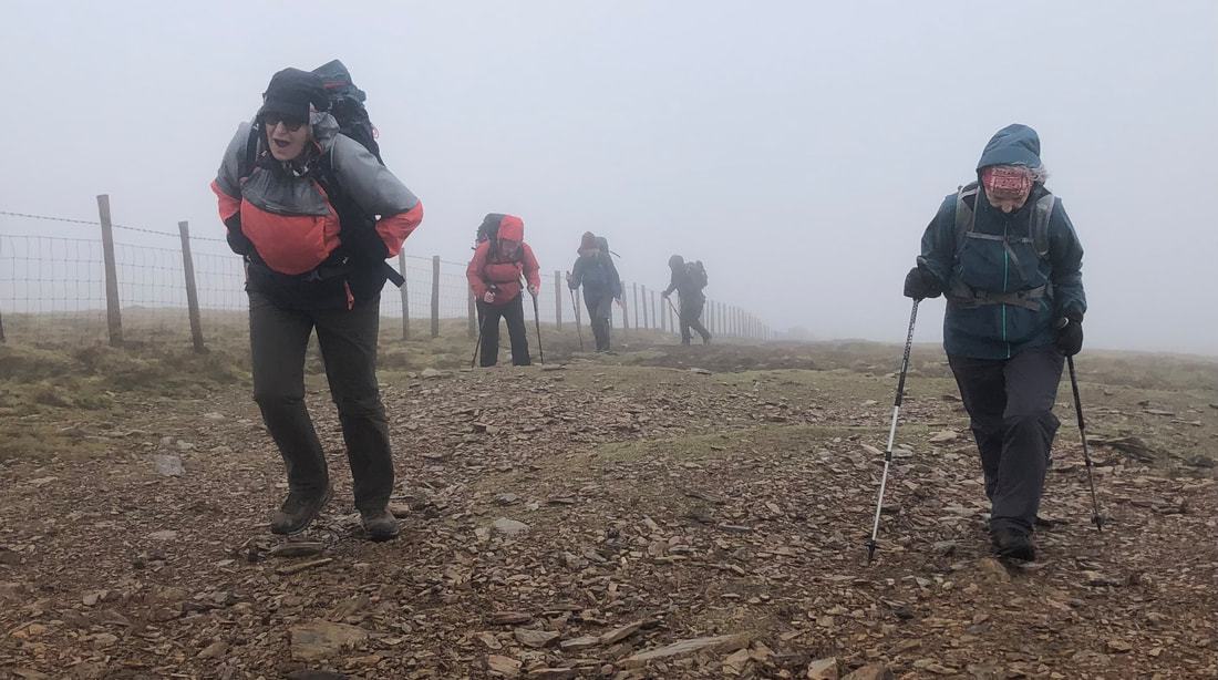
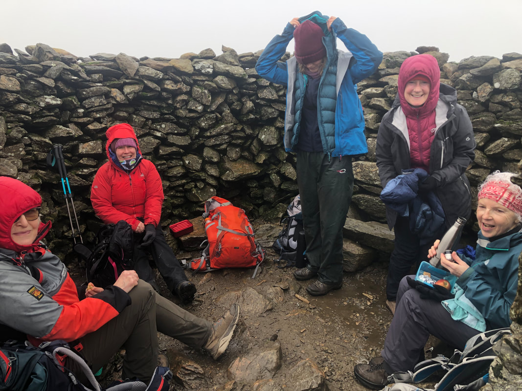
We sheltered in the cairn at the top for our coffee and snacks. It was quite cold but just as we were packing up to continue 3 young girls arrived; they were very kind and offered to take a photo of us but all the time all of us were wondering if they really were kitted out correctly for the conditions. Just after Bwlch Cwm Cesig I used my anemometer and recorded gusts of up to 35mph and general wind speed of 28mph. Not as much as forecast but I knew it could get worse a bit further along.
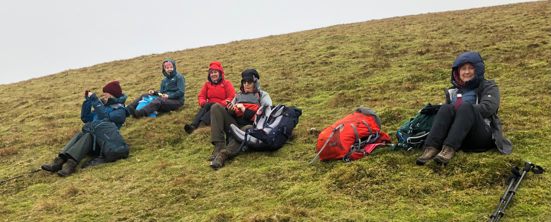
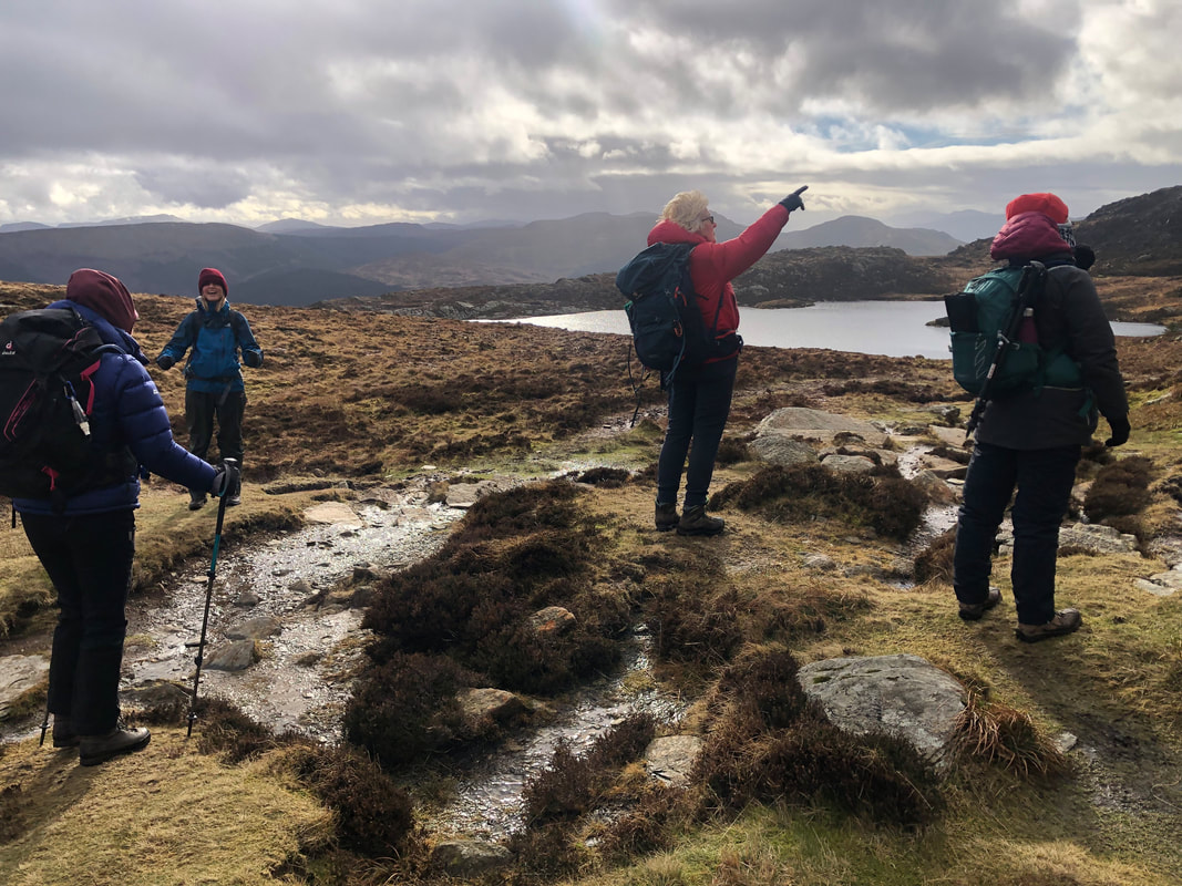
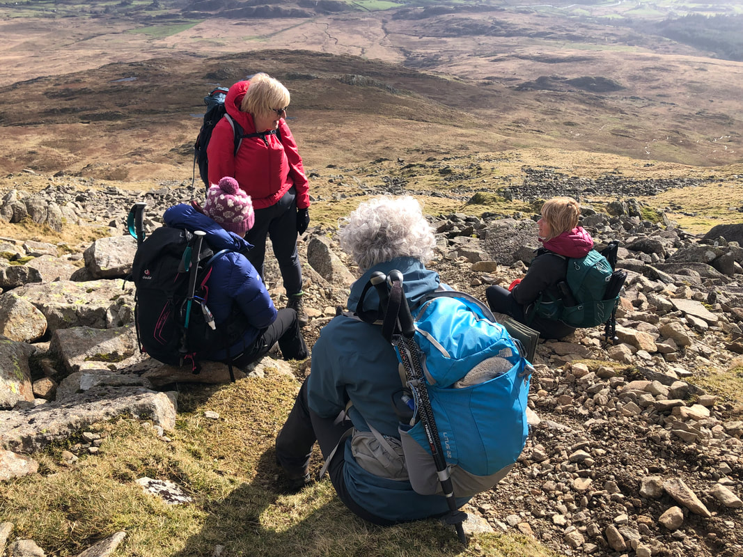
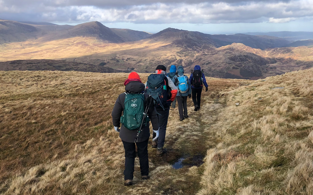
| Sure enough it did so just before the 628m spot height I made a decision to contour round the top of Foel Gron, head south a bit and then approximately southeast to re-join the path at the bwlch before the ascent up to Foel Goch (605m). Once heading NE down the spur of Foel Goch, Cefn Drum, we were in the lee of the wind and could sit on the slopes and enjoy our lunch. The clouds cleared occasionally allowing us to appreciate the magnificent vista in front of us. | 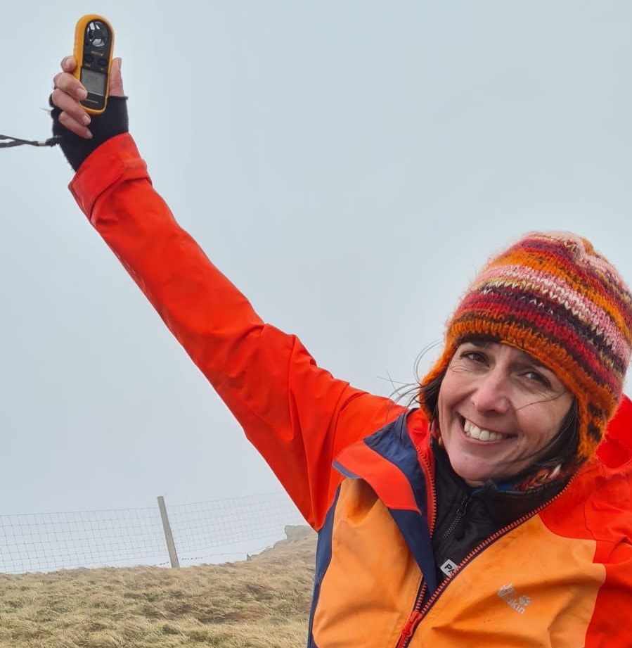 |
‘Moel Eilio was exhilarating in the 25+ mph winds, and with great guides we were able to enjoy our exposure to the elements, knowing we were in safe hands.’ - Sian Davies
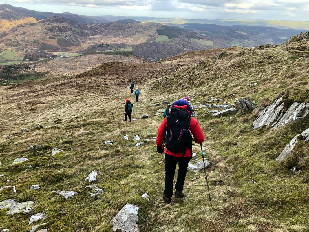
We planned to take the footpaths on the lowlands across the valley base of Afon Arddu that would bring us out onto the lane that comes down from the Llanberis path. There is a café here where we were looking forward to a well-earned cuppa. Closed! Even though Google said open all year round! I knocked on the door (not backing down yet) and although friendly, the owner definitely wasn’t going to put the kettle on.
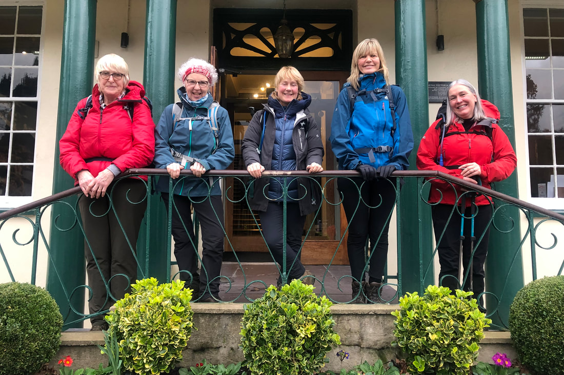 | We had come across an injured snipe on the lane, wing and head damage. There was little we could do so we put it gently the other side of the fence, said our goodbyes and left the rest to nature. At the bottom of the hill The Royal Victoria Hotel, on the other hand, were very obliging and welcomed muddy boots, rucksacks and layers upon layers being draped over our chairs in the bar area. |
Stats – 12.2km, 5 ¾ hrs, total ascent 860m, max elevation 726m, south westerly high winds, 9C, very poor vis, no rain.
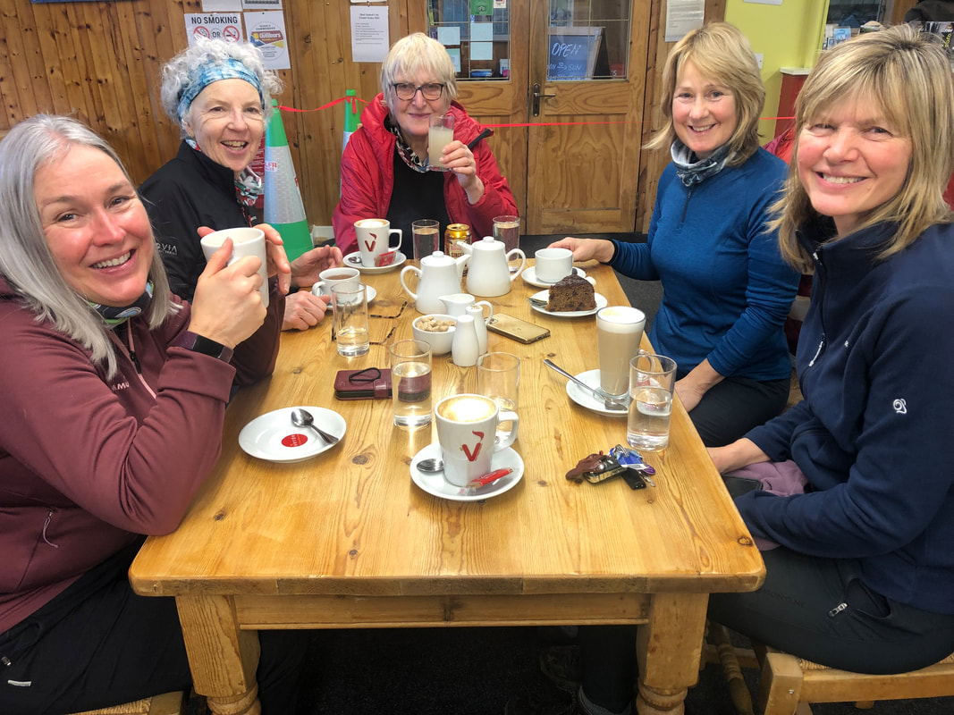
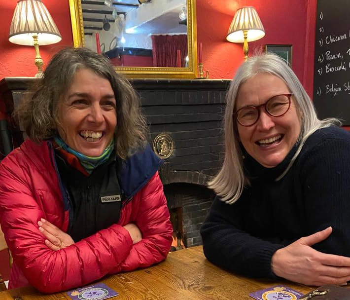
Back at Dol Peris we could sort out our kit, use the drying room if necessary, get showered and ready for a meal out at Spice of Llanberis. It was excellent, the food and service very good and what a great way to round of a day out in the elements.
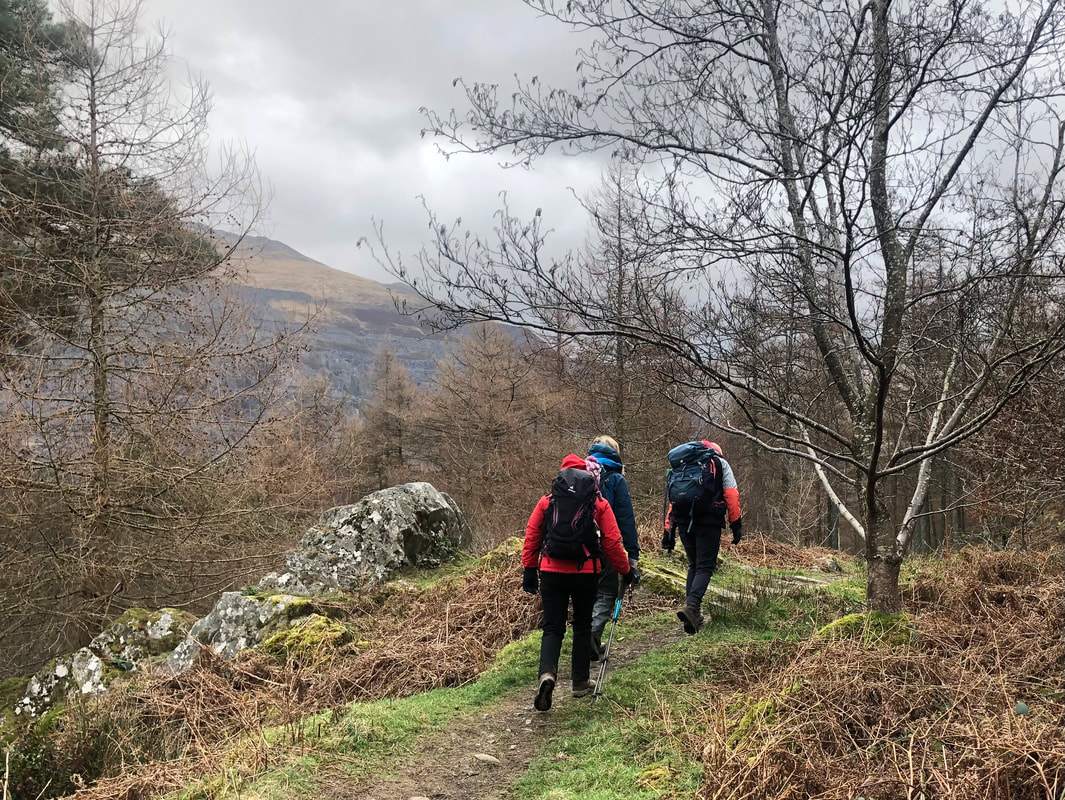
Day 2 Carnedd Moel Siobod (872m)
An early start but for a very good reason…. Breakfast at the Siabod Café!! Everyone in the van, a quick call to check that everything and everybody was in the van, and off we set for a big day ahead. The café deserves its growing fame and popularity; they have got it right in there, great quality food, friendly and helpful service and all sorts of other relevant stuff to look at or buy. Oh, and the best flapjacks. The breakfast order arrived in good time and we were all filling our mountain ready bodies with quality fuel by 9.30am.
A stone’s throw away is the lay-by where we got ready and did final checks and briefing. The Afon Llugwy was looking formidable, carrying a good proportion of the water coming down off the Carneddau (its source is Ffynnon Llugwy Reservoir and joins Afon Conwy at Betws y Coed).
A stone’s throw away is the lay-by where we got ready and did final checks and briefing. The Afon Llugwy was looking formidable, carrying a good proportion of the water coming down off the Carneddau (its source is Ffynnon Llugwy Reservoir and joins Afon Conwy at Betws y Coed).
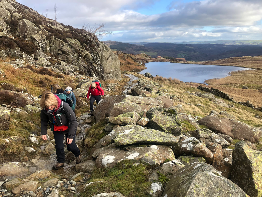
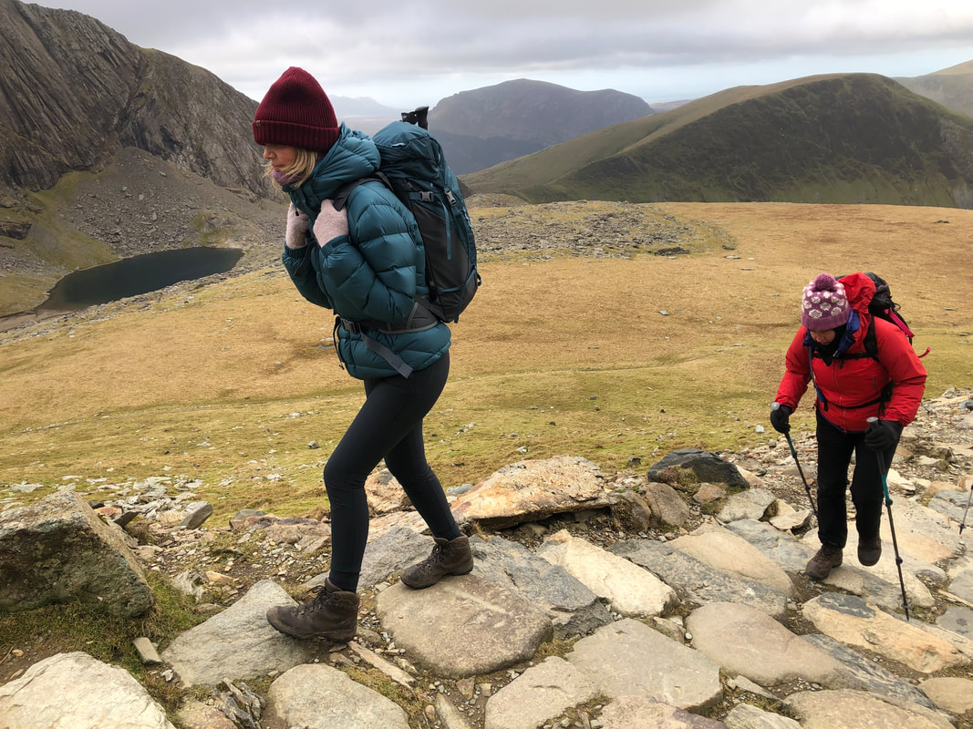
| It’s uphill from the start gaining height quickly before it levels out when the open hill is reached. The northeast end of the ridge on Moel Siobod was viewed most of the time on the way along the old mining track to the small, dammed lake (with no name). from here we decided to reach the quarry lake before stopped for our morning coffee. |  |
There was another group of walkers who seemed to be just where we wanted to be on more than one occasion, so we headed a bit further up above the lake and settled there for coffee and snacks. Breaks in the high clouds were letting through warm spring-like sunshine; we were all stunned by the warm hues of the rocks and vegetation which naturally complemented each other, and the sun being on its low winter arc created contrasts and shadows creating a combined effect that our phone cameras would never really capture – you had to be there.
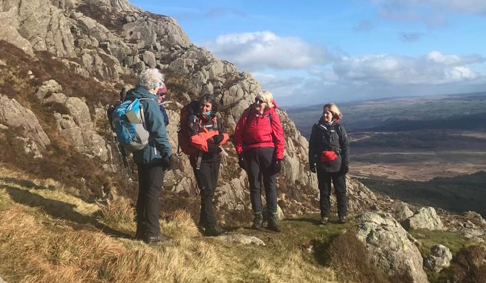
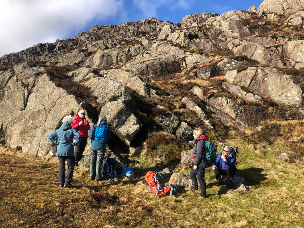
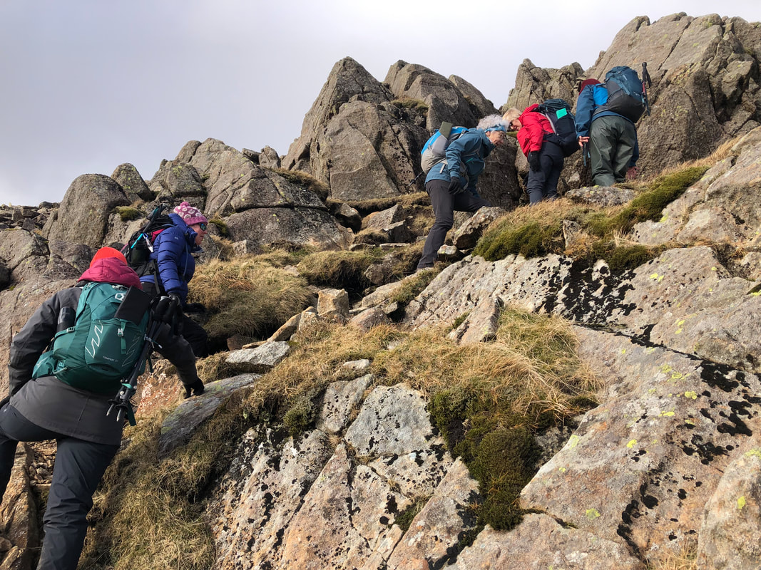
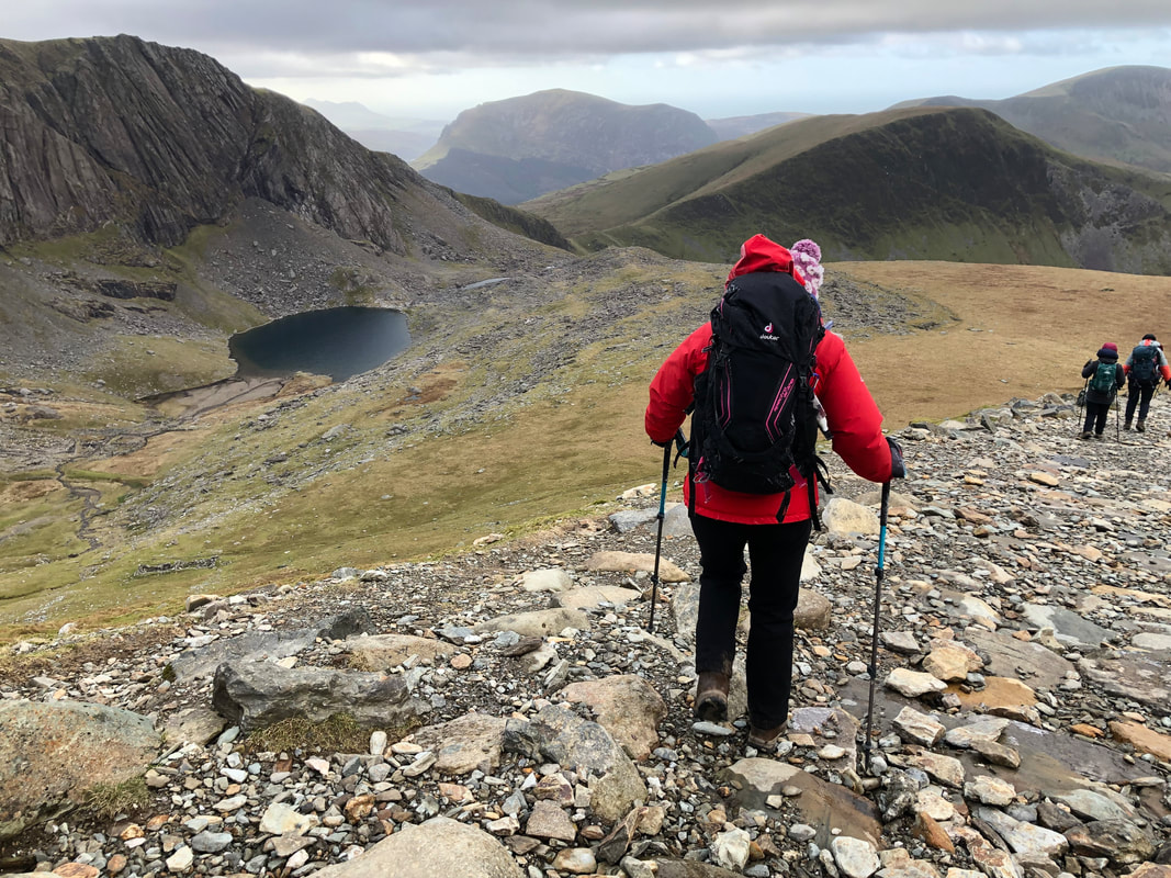
In the cwm* of the mountain, where Llyn y Foel sits, it is always boggy so this time we decided to take the ‘café recommended’ route around the southside of the lake. We did encounter plenty of water but managed to get round to the other side without too much difficulty. Heather had done the climb only 2 weeks previously so she led the way from here – the climb! (the other group of walkers were taking the ‘Daear Ddu’ route - rather them than us with the strong westerly winds).
Even though the route is challenging and needed focus at times, the path was very much more visible than 2 years ago, I think this is because the café have certainly promoted the mountain in the last 5 years, and in the last 2 years Snowdonia has been swamped with visitors without time to recover.
*cwm - (especially in Wales) a steep-sided hollow at the head of a valley or on a mountainside; a cirque. No exact equivalent word with the right meaning.
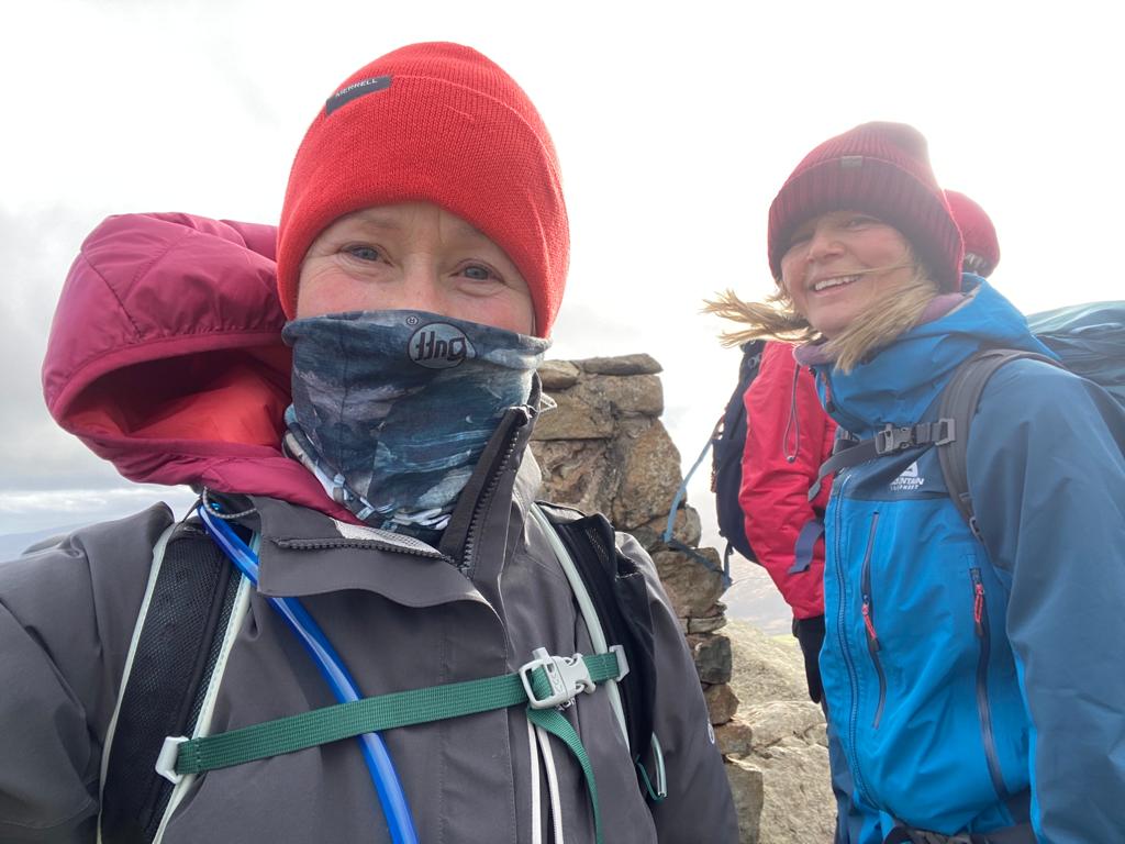
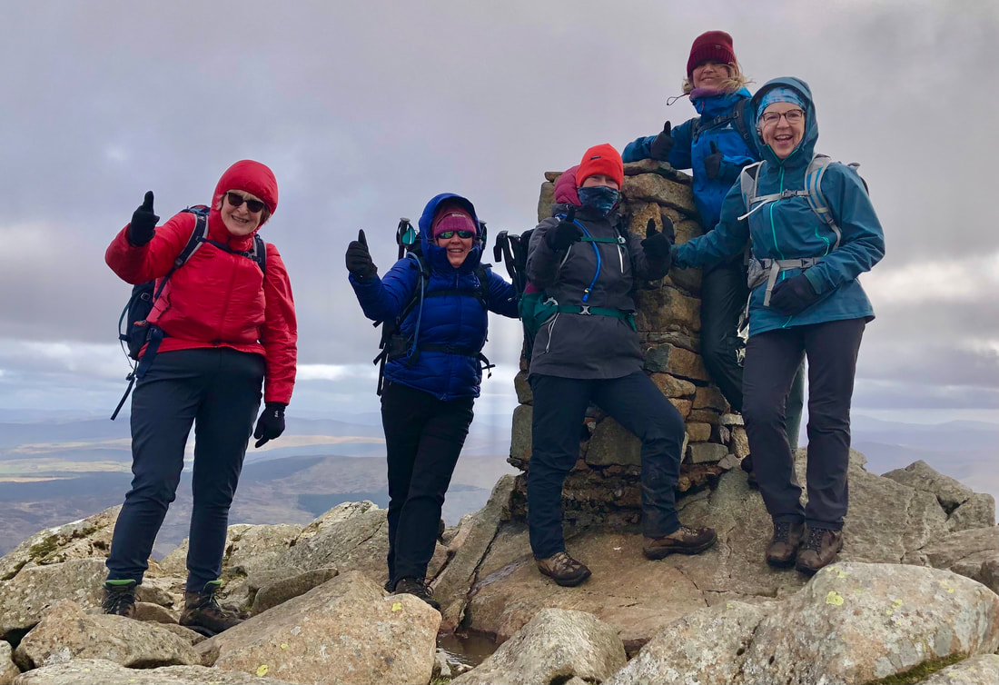
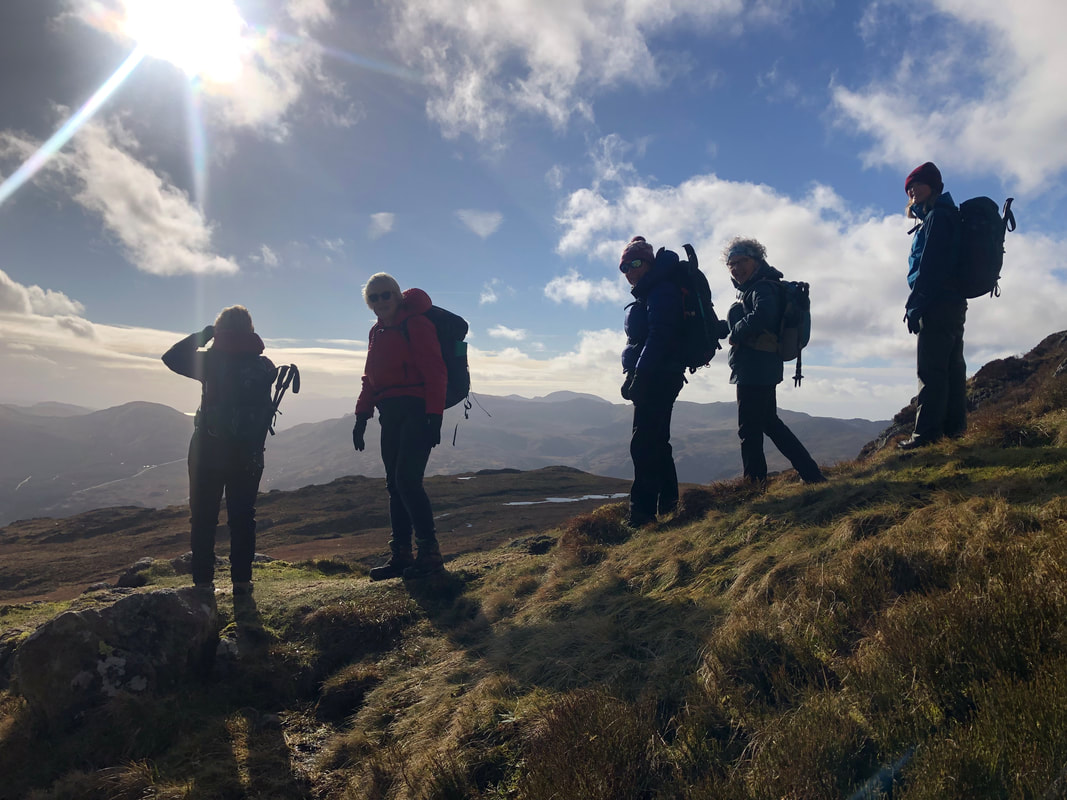
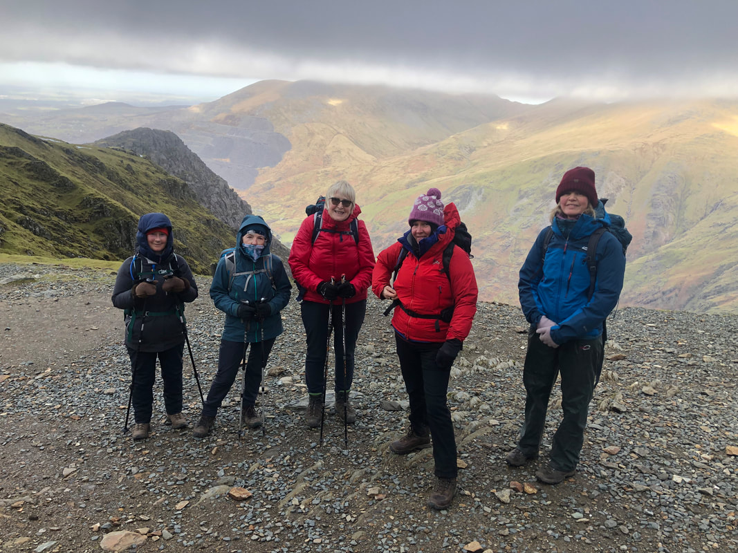
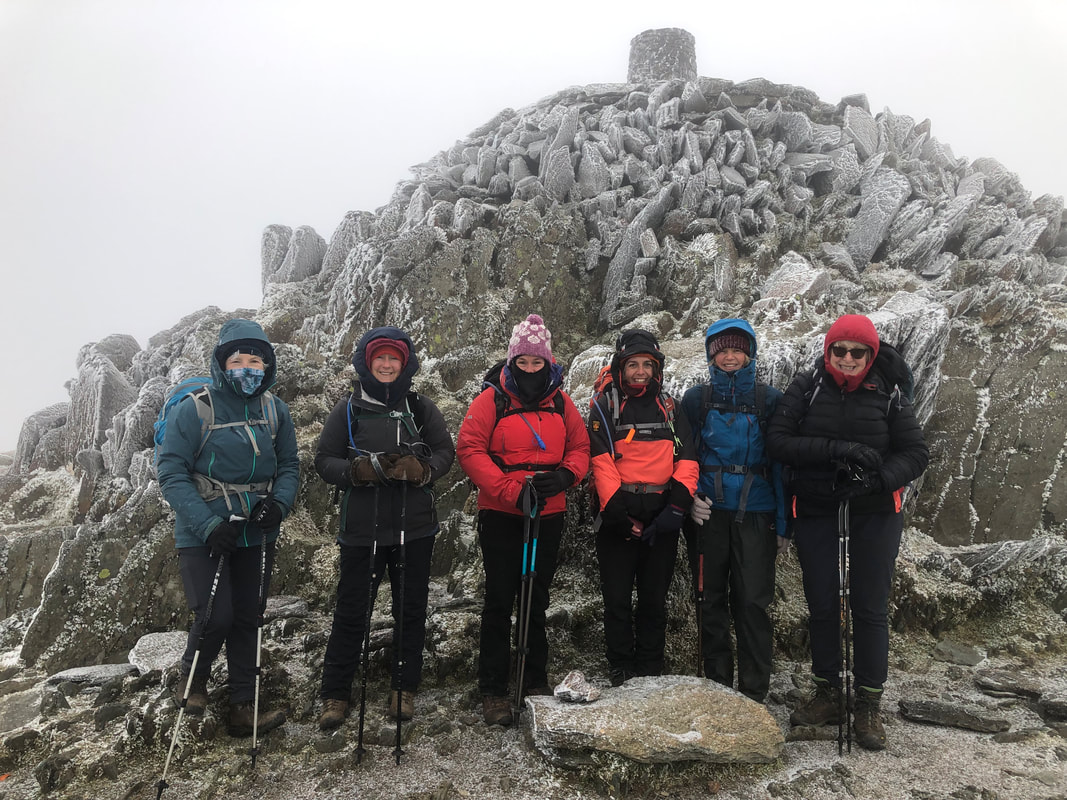
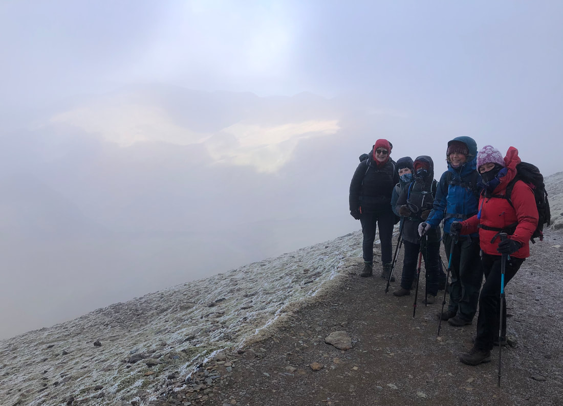
On reaching the top everyone was happy with a sense of achievement and the views were fabulous. It was very windy so quick photos at the trig point and then we made a bee line for the cairn shelter. The wind was blasting its way through the gaps in the rocks, so we all put on an extra layer, I popped my head above the parapet only to find that the views were fast disappearing and a snow cloud was heading our way. I gave the group a minute or two to pack up and it was sharp exit from the top while we still had good visibility.
‘Seeing all those smiley faces on the summit of Siabod, great sense of achievement.’ - Heather Maling
The descent from the top northwards requires good balance in stepping over small boulders until an easier path is reached. We caught the tail end of the snow cloud with just a flurry of snow, it passed quickly. I couldn’t quite believe that looking NE we could see the wind farm out at sea in Colwyn Bay. The air pollution must have been very low, no haze. Staying on this contour more or less northeast to a stile and a path that takes us on the main spur of the mountain and a route down - at times was either very wet or meant carefully negotiated steps down a very eroded path.
 | One of us thought about visiting the Siabod café on our return so we checked the opening times and reckoned that we would be just in time for refreshments. So exactly 7hrs later we were back supping on very good coffee and stocking up on flapjacks. |
‘Punctuated between pre- and post-fuelling visits to the Siabod café, this climb offered some more technical challenges, and we were rewarded with jaw-dropping 360° views, spotting Dolwyddelan castle down below – and the formidable Tryfan from the trig!’ – Sian Davies
Stats – 10.8km, 6.5hrs, total ascent 787m, max elevation 872m, westerly high winds, 7C, very good vis, no rain, a flurry of snow.
A relaxing evening at Dol Peris lay ahead; everyone made their own meals and we sat round the fire and chatted until we turned in one by one.
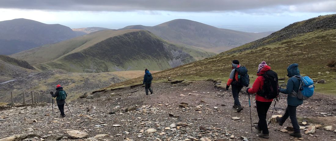
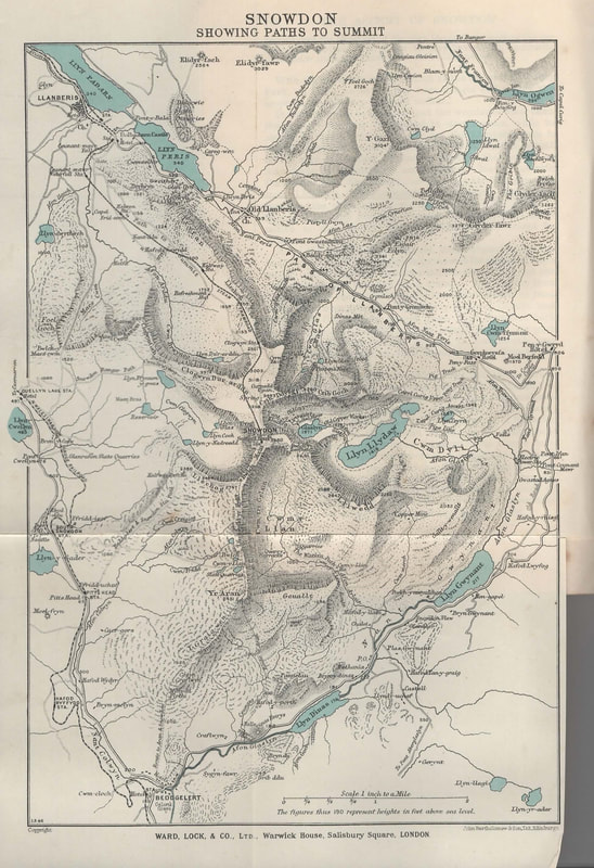
Day 3 Snowdon (1085m)
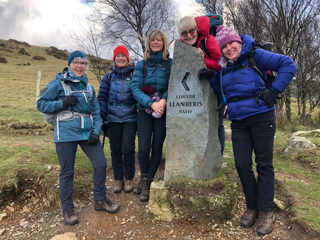
Thursday had remained the best day weather wise to attempt Snowdon and up and down the Llanberis path would give us the best chance of succeeding. Strong westerly winds were forecast so the route of the Llanberis path would be a safe option too. Some of the best views are on this ascent. So, with sun forecast to appear at around midday and light snow showers forecast on and off all day I reckoned an RV of 0830 would give us a good start. We left the van at the Royal Victoria Hotel and Heather nipped in to get permission for parking, with the promise of us having drinks there at the end of the day.
Instead of taking the lane we took the path up through pretty woodland re-joining the lane by the ‘closed’ café. The owner was about - We were a bit surprised to learn from him that if we’d said on Tuesday that we were staying at Dol Peris he would have put the kettle on. At that point two walkers arrived, having already bagged the summit and were let in for their morning cuppa; they appeared far too busy, knackered or perhaps too important to even give us a friendly ‘good morning’. All quite strange but it gave us something to talk and laugh about.
We checked on our deceased snipe – still intact but definitely dead, poor thing.
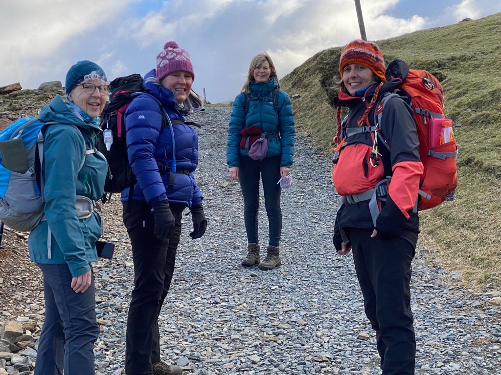
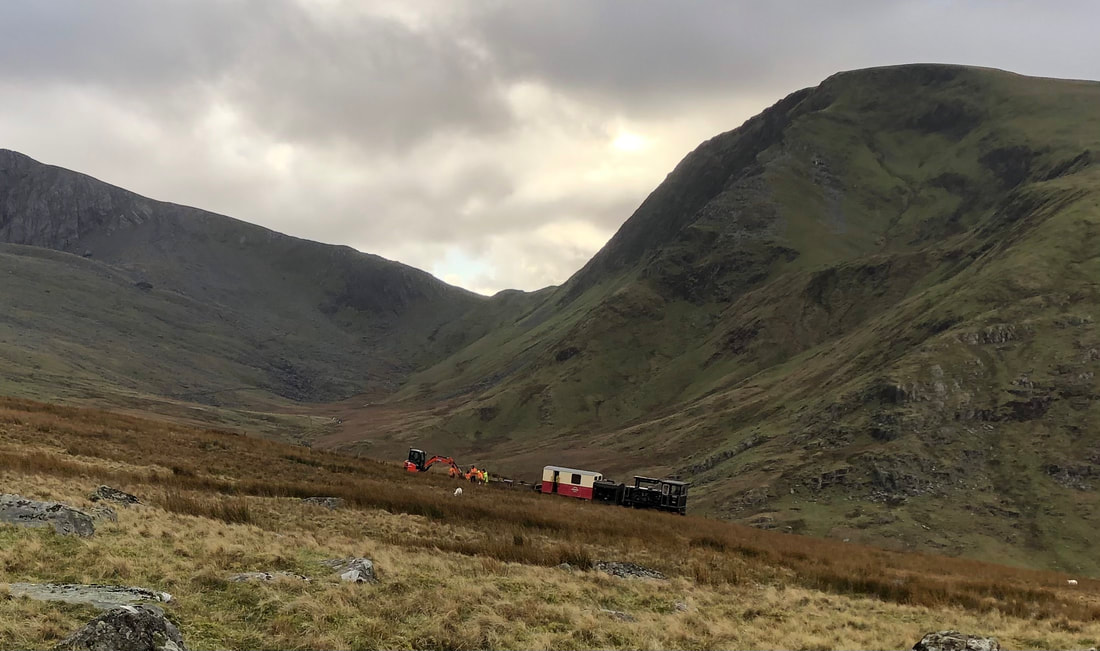
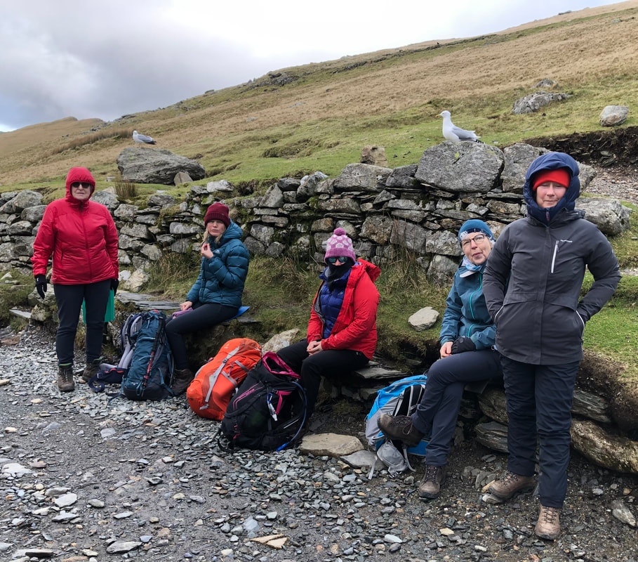
It didn’t seem long until we reached the Half Way House café (approx. 540m). I don’t think I’ve ever seen this open and with passing trade every day I wondered why it doesn’t open more. It’s a pity because the west facing wall provides privacy for a comfort stop which I’m sure many walkers take advantage of – if it was open, I don’t think that this would happen.
We could see over to Moel Eilio which was really satisfying; now everyone could see where they had walked on Tuesday. It had been such poor vis we could have been anywhere but now it all fell into place. Heather told us stories on the way up from her days of working in the café at the top and of being in the rescue team. She was able to tell us that the stationary train and the workers on the track was called the P-Way (P short for permanent) and was there for maintenance. There were quite a few workers bussing about in their hi-vis PPE. I hoped for them that they had some kind of warmth in the train carriage, dealing with all that freezing metal and in such chilling winds made me feel cold just thinking about.
We could see over to Moel Eilio which was really satisfying; now everyone could see where they had walked on Tuesday. It had been such poor vis we could have been anywhere but now it all fell into place. Heather told us stories on the way up from her days of working in the café at the top and of being in the rescue team. She was able to tell us that the stationary train and the workers on the track was called the P-Way (P short for permanent) and was there for maintenance. There were quite a few workers bussing about in their hi-vis PPE. I hoped for them that they had some kind of warmth in the train carriage, dealing with all that freezing metal and in such chilling winds made me feel cold just thinking about.
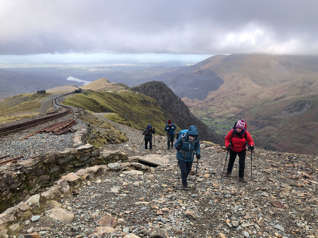
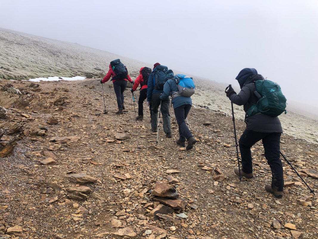
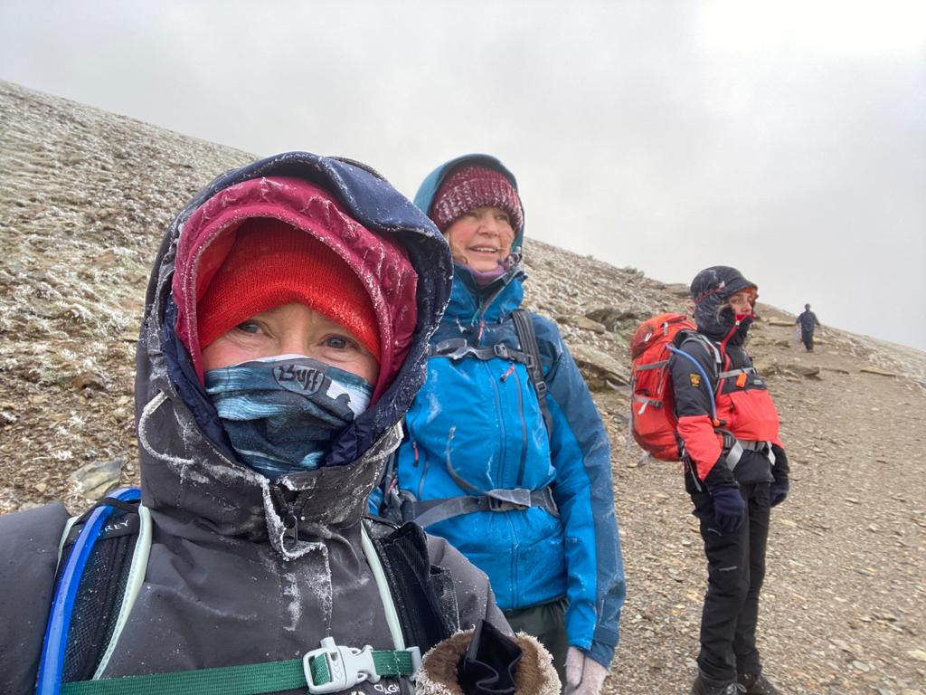
Just past the café the temperature was noticeably dropping, there were tiny signs of ice on the path and the winds were definitely getting stronger. A friendly walker had stopped to say hello so I asked him what the conditions were like at the top; his water in the tube had frozen but he said there wasn’t much ice under foot – all useful information. Once under the bridge (approx. 775m) and in the lee of the wind we stopped to put on extra layers.
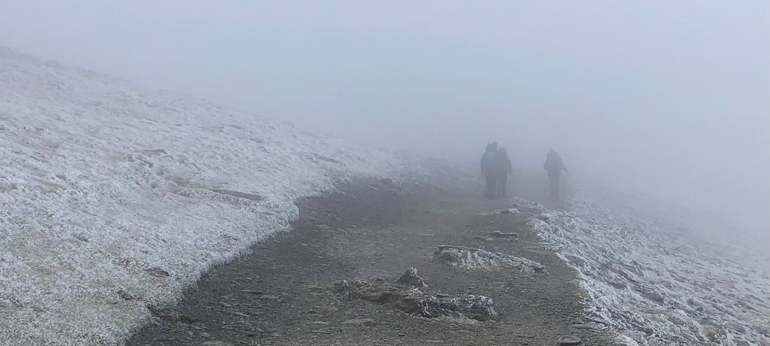
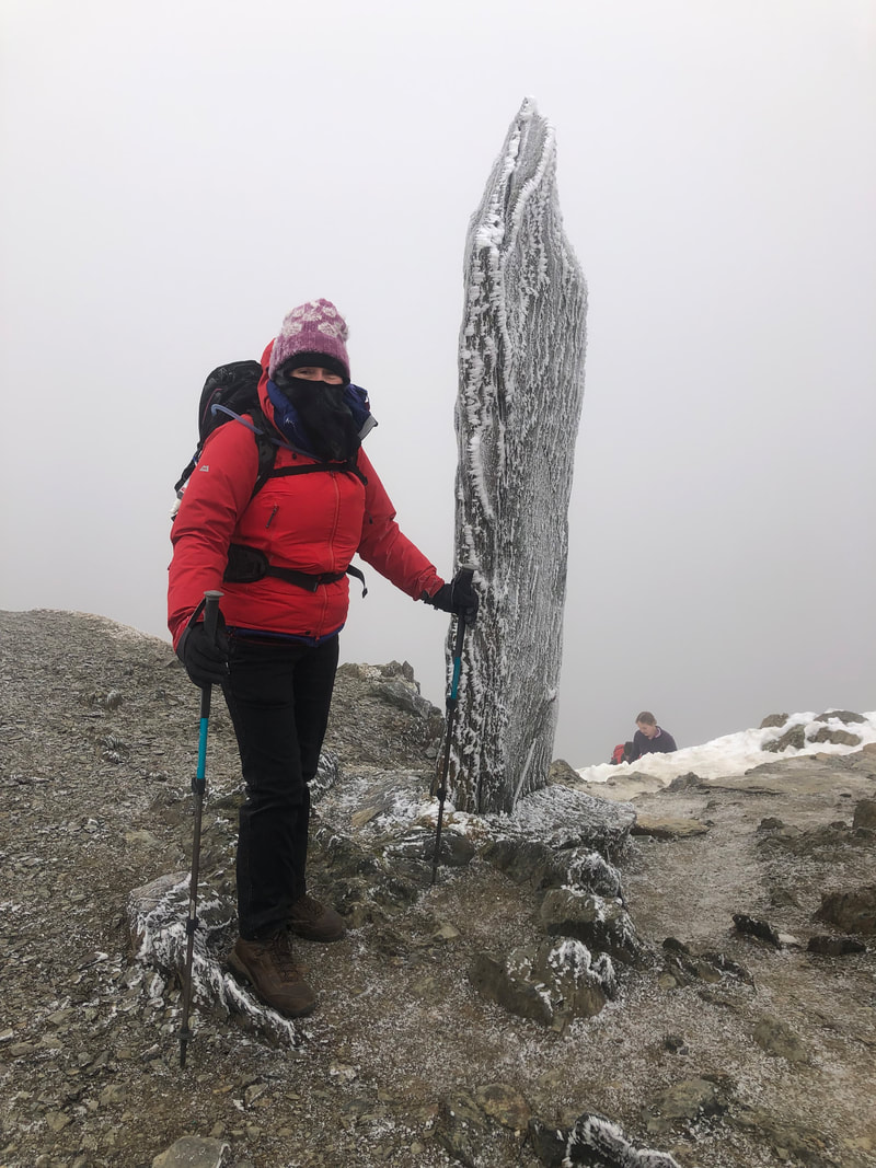 | From here the gradient increases and for a while the ground is quite lose but the cold conditions had actually made this easier as the small bits of grit had stuck together, yet it wasn’t slippery. We soon reached the cloud (approx. 900m), although the visibility seriously dropped, the path remained clear and we could battle on. After 3hrs and 20mins (from the start) we reached the top. The heavy frosty-like covering on the rocks was amazing – one of nature’s works of art. It was seriously cold so we found some shelter by the café wall, layered up and devoured what we could in a short space of time before a quick photo by the trig point. |
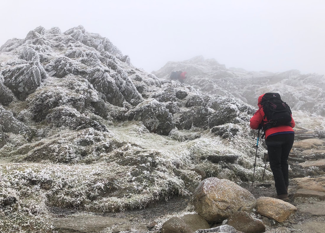
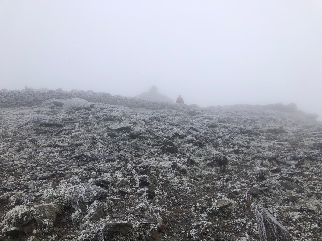
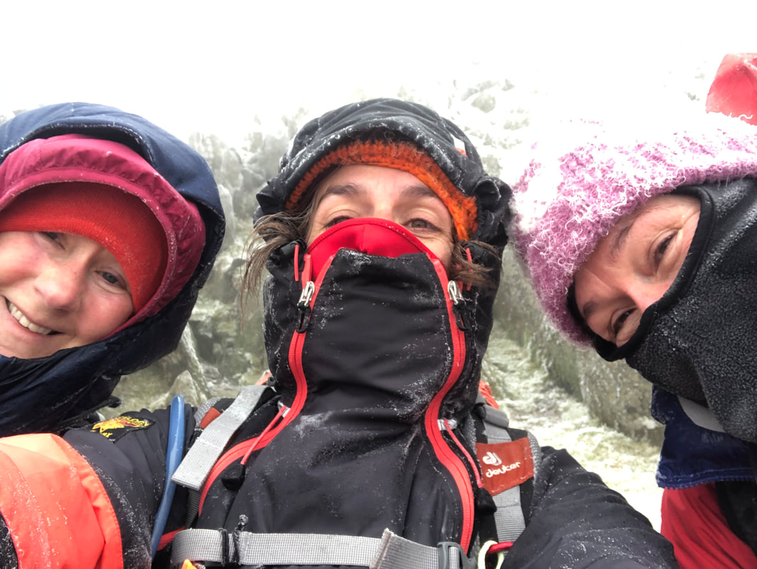
| Care had to be taken on the steps up to the base of the cairn and I ruled out going any further ie up to the trig – it was too slippery, windy and gusty. Everyone was happy with this decision and someone kindly offered to take our photo. If it hadn’t have been quite so cold I would have beckoned for a group hug, I felt quite emotional for the ones whose first time it was on Snowdon – great when it’s so memorable, who needs views! I think we had timed it just right, an hour or two later and there would be a lot more ice where there was water running on the path. | 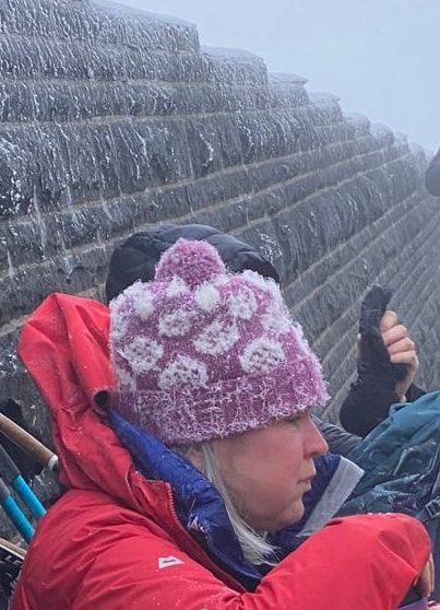 |
Onwards, and it would now be down, down, down! The strong wind and sharp, icy droplets hitting the left-hand side of our faces was quite painful, so each of us with minimum amount exposed all pushed on and remained focussed. I felt very proud to have such a great team with me – very strong, very competent.
‘The Wind Chill factor as we ascended on the Llanberis path on the final day did not detract from the buzz of reaching the very frozen and white Wyddfa Summit. The descent was equally thrilling, as the surrounding peaks popped in and out of our vision.’ - Sian Davies
 | It was quite a shock to emerge from under the clouds, a superb vista which only added to everyone’s high spirits. We had one short stop at the Half Way House and in 2.5 hrs (from the top), we were keeping to our promise and enjoying a drink in the Royal Victoria Hotel with a very big cheers! Well done everybody! |
Stats – 15.8km, 6 ¼ hrs, total ascent 1018m, max elevation 1085m, westerly high winds, 4C at approx 400m (wind chill -14C at the top), mixed vis, no rain, icy drizzle at the top.
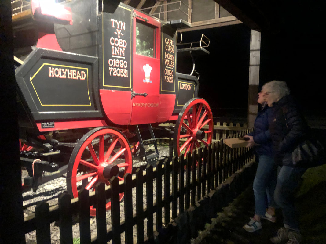
The accommodation at Dol Peris gives you the guarantee that you have everything you need at the end of a challenging and enjoyable mountain day; hot shower, space to put all your kit and a welcoming homely atmosphere. This is what we all needed and with a quick turnaround we were all refreshed and ready to jump in the van and go up to the Tyn y Coed for our evening meal. Built in the 19th century to accommodation the growing number of visitors in north Wales. Outside proudly stands an old stage coach. We had booked a table just in case and although quiet in there, there was a fantastic coal fire chucking out the heat. I like to think this was lit just for us! It was certainly appreciated. The food arrived quickly and we were all pleased with our choices.
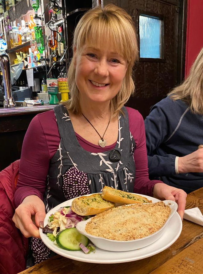
Wine flowed as did conversation and laughter. I was driving so enjoyed a ginger beer and peppermint tea with my very big burger and sweet potato fries. Heather and I were each presented with a lovely thank you card, signed by all, a bar of 70% chocolate and the cost of our meal covered; extremely kind and a very thoughtful acknowledgment from our intrepid group.
The end of the week had come round all too soon but there was one last task to do and that was breakfast at the famous Pete’s Eats in Llanberis on Friday morning. It was raining heavily so 3 of us ran down to get a table only to find it wasn’t open until 1000. I had checked several times on google but I suppose it always pays to look at the opening hours on the actual door. The Siobad Café it is then, and with no doubting from anyone we all jumped in our cars and drove in convoy to our favourite caf’. And guess what? They recognised us…
After much summing up of the 3 walks and experiences we said our good-byes and embarked on our journeys home.
After much summing up of the 3 walks and experiences we said our good-byes and embarked on our journeys home.
Summing Up
‘My most memorable moment isn’t one that is easily identifiable. For me it is about being part of a team. Enjoying each other’s company in a way that is supportive - not competitive in any way, I guess. I love the social side of it as well. The mountain walking is always a challenge with the mountains you choose but secretly I know I will get there anyway! The female environment and support is a new thing in my life which I love.’ - Wendy Cottis
‘Thank you, Helen of ‘Bryn Walking for Women’ for an amazing 4 days in the mountains of Snowdonia, 3 challenging treks, all very well organised, my favourite was Moel Siabod. I look forward to more events with this group. I would certainly recommend them.’ - Jayne Kirk
‘Exciting, challenging, relaxing and very therapeutic but guided and supported all the way by Helen! A fabulous time spent in Snowdonia – Thank you.’ - Anabel Powell
‘So many memorable moments Helen….involving goats and Siabod flapjacks mostly!! Three excellent and different walks over the three days. A truly memorable few days, diolch o gallon.’ - Sian Davies
‘My favourite day was Snowdon. The change in conditions and immediate scenery was incredible and I felt so happy (was holding back happy tears) that we’d achieved the summit for those who hadn’t been there before. We had done so safely and with no hesitation to turn back on the way if necessary. I felt proud of all of you – fit, competent and capable and above all, smiling through-out. Thank you for your great company and courage and supporting Bryn Walking for Women and for your anecdotes and some of the photos for this blog. Last but not least, thank you to my very good friend Heather for assisting me all the way on this event and providing stories from Snowdonia throughout the week.’ - Helen Menhinick (Mountain Leader and author of this blog)
Words from Writers who Travelled Wales
George Borrow Wild Wales 1862
‘Snowdon or Eryri is no single hill, but a mountainous region, the loftiest part of which, called Y Wyddfa, nearly four thousand feet above the level of the sea, is generally considered to be the highest point in southern Britain. The name Snowdon bestowed upon this region by early English on account of its snowy appearance in winter; Eryri by the Britons, because in the old time it abounded with eagles, Eryri in the ancient British language signifying an eyrie or breeding-place of eagles. Eryri likewise signifies an excrescence or scrofulous eruption. It is possible that many will be disposed to maintain that in the case of Snowdon the word is intended to express a rugged excrescence or eruption on the surface of the earth.
The Wyddfa is about 30 feet in diameter and is surrounded on three sides by a low wall. In the middle of it is a rude cabin, in which refreshments are sold, and in which a person resides throughout the year….. Below on all sides are frightful precipices except on the side of the west.’
H. A. Piehler - Wales for Everyman 1935
‘Y Wyddfa (‘the tomb’ or ‘the view point’ or ‘the conspicuous’) is the central summit, marked by a cairn. The summit of Snowdon is a dismal litter-strewn spot, degraded by its popularity and redeemed only by the view. The Snowdon Summit Hotel consists of two wooden huts, where meals or refreshments (alcoholic or otherwise) are obtainable in summer, and where the night may be spent by those who want to see sunrise. A letter box and telegraph office are available.’
E. G. Rowlands - Walking in Snowdonia 1951
‘It is of interest to note that, while long usage has made Snowdon the name of the peak, the Welsh title is Y Wyddfa, meaning the tomb or barrow, from a legend that a giant was buried there. The word Eryri, still sometimes used, is shortened from “Creigiau Eryri” or the rocks of the eagles, a term applying to the whole region round the summit. Today no eagles fly there.’
H. V. Morton – In Search of Wales 1932
‘On the very crest of Snowdon is a small, wooden hut. I went inside. Men and women were standing before a friendly stove drinking hot coffee. I noticed the train conductor.
‘This cloud will blow away soon?’
‘You’ll see nothing today’ he replied. ‘There will be no view whatever’’
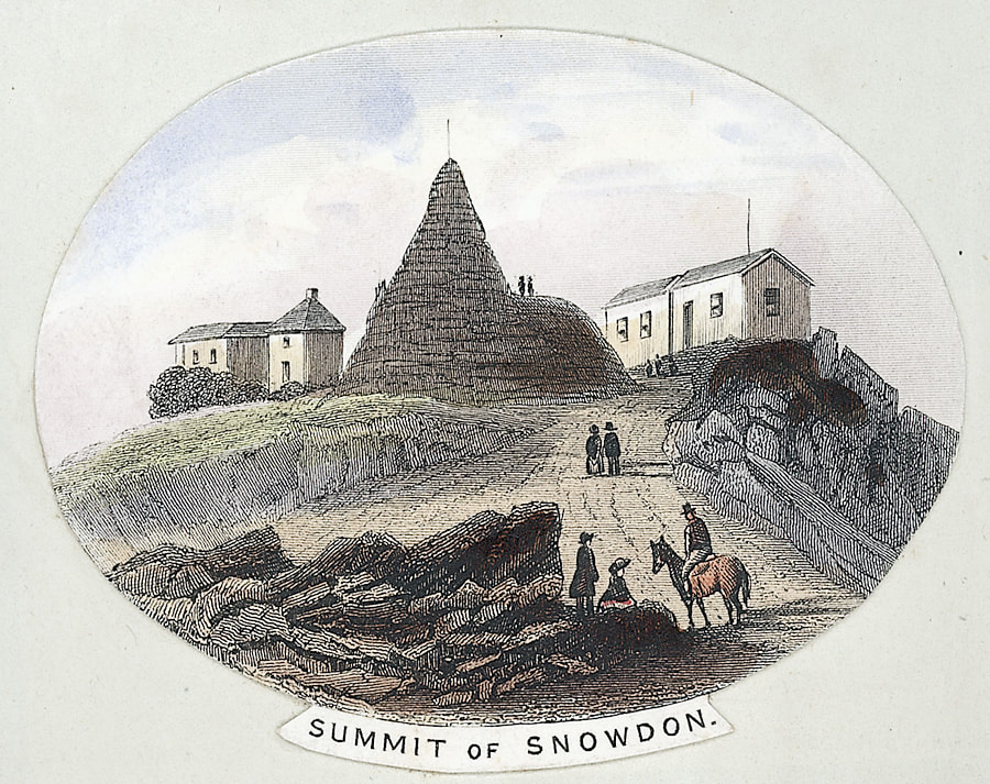
Snowdon Summit - A Bronze Age History or not?
There is no solid evidence that there was a Bronze Age burial cairn on the summit and some information I’ve read seems quite positive that there isn’t but RCAHMW, which I would take to be the most reliable seems to suggest that it’s quite probable, see below. Folk law suggests that it was the burial place of the giant Rhita. Lots of information can be found on the internet, one particular site being Sublimewales where it will tell you all about Rhita. It is also thought that Ordnance Survey built a cairn on the summit in 1827 before the huts. Here is the extract from RCAHMW.
| | NGR : SH60985437 Site Type : Bronze Age CAIRN Description : A presumable Bronze Age funerary cairn located on the summit of the highest mountain in Wales. The original cairn has been altered beyond recognition by generations of hill walkers, mountaineers and sightseers. A trig point marks the highest point. Early photographs of the Snowdon summit show a large flat topped cairn. It degrades periodically due to erosion by visitors and the elements, and is reconstructed from time to time. An OS trig point was erected on the summit cairn at some point. Sources : Gwynedd Archaeological Trust , 1998 , PRN 13943 Hollamby, K., A Desk-Based Archaeological Assessment of Snowdon Summit (2003) | |
The History of the Buildings on the Highest Point in Wales
My Assistant Leader on this trip, Heather Maling (ML) lived and worked on Snowdon for 4 years, running the café. Here is her account.
 | 1986 to 1989 The Local newspaper said, "Cop Quits for Wales’ Top Job". I was offered the job running the summit building by the previous manager who then became my boss. Four of us lived up on the Summit for the whole season- End of May til the beginning of October. Four travelled up and down by train every day. It was physically the most challenging job I ever did, working 7 days from 8am til (often) 8pm. The best times were in the evening when all the trains and people had gone, and we sat watching the sun set over the Irish Sea. |
Building Nos.1 & 2
The first shelter was built on the summit in 1820, selling refreshments and providing shelter for walkers. By 1847, there were several log cabins and two hotels on the summit. "The Roberts Hotel" which was run by John Roberts and the second "Cold Club" which was run by William Roberts (no relation). There was fierce competition between the two businesses. Apparently, both hotels were in poor condition and more often than not there were more visitors than beds.
Following legal negotiations in 1896, the “Snowdon Mountain Tramroad and Hotels" company took over the responsibility for the two hotels, and by 1898, work began on rebuilding of the hotel and adding a veranda. A small hut was also built for railway staff at the site of the existing cafe, but was not there long. A small station was opened in its place. The buildings were greatly affected by the inclement weather, and by 1930 all the buildings were in terrible condition. It was resolved that a multi-purpose building would be build in their place, to include a hotel, cafe and a train station. The old buildings were demolished over the hillside to make room for the new buildings. Source
Building No.3
The new building was designed by Sir Clough Williams-Ellis, the architect who designed Portmeirion, and the building was completed in 1935. The most prominent features were huge windows on the front and side of the building for visitors to enjoy the scenery. Unfortunately, the windows shattered in a storm six months later, and smaller windows were installed in their place. The cafe was closed during the Second World War and was used by the Ministry of Supply for experimental radio work, and later by the Air Force to develop radar. The Admiralty carried out intelligence work there for a while and finally it was occupied by the Army. Despite the improvements that were made in the 1950s and 1960s, the cafe deteriorated.
In 2004 it was decided to rebuild the cafe and build a new visitors' centre. Clough Williams-Ellis' structure was demolished in 2006 and once again the weather was a hindrance. Source
Building No.4
In 2009 the new café opened
Friday 12th June 2009 The Guardian wrote – ‘ A new cafe and visitor centre at the peak of Snowdon, replacing the 1930s concrete building once described by Prince Charles as the "highest slum in Wales", finally opens today after a tricky construction process repeatedly delayed by bad weather. Rhodri Morgan, the Welsh first minister, is to officially open the £8m building, which is made of granite and intended to blend in with the scenery on the 1,085m peak, the highest in Wales. Officially called Hafod Eryri, the structure by architect Ray Hole, which includes a viewing wall of glass at the front, had been due to open in spring last year but was held up by particularly poor weather conditions.’
And lastly, a poem aptly titled Epilogue
EPILOGUE to Alun Mabon
Still the mighty mountains stand,
Round them still the tempests roar;
Still with dawn through all the land
Sing the shepherds as of yore.
Round the foot of hill and scar
Daisies still their buds unfold;
Changed the shepherds only are
On those mighty mountains old.
Passing with the passing years
Ancient customs change and flow;
Fraught with doom of joy or tears,
Generations come and go.
Out of tears’ and tempests’ reach
Alun Mabon sleeps secure;-
Still lives on the ancient speech,
Still the ancient songs endure.
J. Ceiriog Hughes (1832-87) Translated from Welsh by Sir. H. Idris Bell Source – A book of Wales 1953
NB. Mabon - God of Welsh mythology, Mabon. He is the Child of Light and the son of the Earth Mother Goddess, Modron and part of King Arthur’s war band.
NB. Mabon - God of Welsh mythology, Mabon. He is the Child of Light and the son of the Earth Mother Goddess, Modron and part of King Arthur’s war band.
Thank you for reading my blog. Until next time, bye for now.
Bryn Walking and Bryn Walking for Women are trading names for Menhinick Outdoors Limited
Bryn Walking and Bryn Walking for Women are trading names for Menhinick Outdoors Limited
2 Comments
Wendy
18/2/2022 20:00:32
Excellent account of our week Helen. It is great to be reminded of our travels and for them to be recorded. I love all the photos. I look forward to your trip and more laughs!
Jayne kirk
19/2/2022 15:33:11
Thank you Helen for a truly wonderful Blog, such a lot of research to enrich our experiences. I felt very emotional reading it.
The work you put in before and after the events is incredible and I am so pleased to have been part of an incredible group of women. All of you are so inspiring.
I am looking forward to attending more.
Thank you.
Leave a Reply.
Archives
April 2024
March 2024
February 2024
December 2023
November 2023
October 2023
May 2023
March 2023
October 2022
September 2022
June 2022
May 2022
March 2022
February 2022
May 2020
April 2020
November 2018
October 2018
June 2018
May 2018
March 2018
February 2018
January 2018
December 2017
November 2017
 RSS Feed
